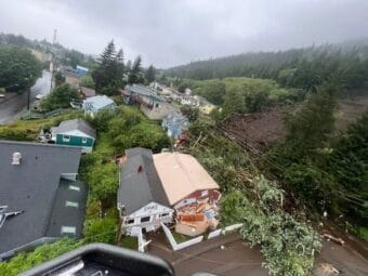
Rainfall saturating the ground, potentially triggered by wind, are common culprits in landslides in Southeast Alaska.
"Alaska Division of Geological and Geophysical Surveys"
Alaska is short on gravel and long on development projects
The state’s North Slope communities need rocks, and they’re hard to come by.
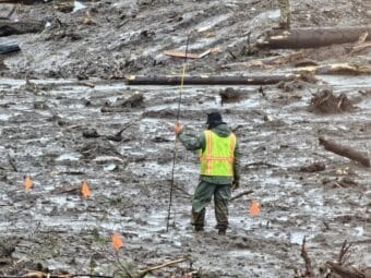
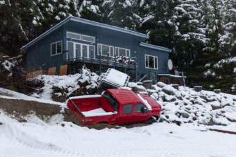
‘We’re always going to be surprised’: Wrangell’s tragedy highlights Alaska’s lack of landslide monitoring
Scientists say Southeast mostly lacks the kinds of monitoring that could make people safer.
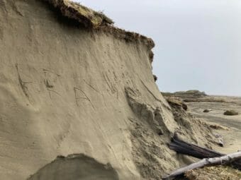
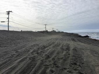
Many of Hooper Bay’s dunes were washed away by the storm. Without them, residents feel exposed.
The storm eroded about 300 feet of coastline, bringing the water that much closer to town. The loss of Hooper Bay’s dunes has potentially serious consequences.

FEMA approves funding for landslide mapping in Haines
Teams will collect data during plane and helicopter flyovers using lidar, a type of scanner that bounces light off of the terrain below to provide a detailed topography of the landscape.
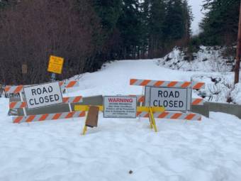
Homeowners plea for access to Beach Road as Haines Borough assesses landslide hazard
The Haines Borough says it is still unsafe for some residents return to their homes on Beach Road after a landslide swept through the area last month. But some homeowners say they need access so they can gather belongings and protect their homes from deteriorating while they’re unoccupied.
Climate change, wetter weather could put more Haines homes in jeopardy
Last week’s storm and landslides revealed that much of Haines, where there are no building codes, wasn’t constructed with landslides in mind.
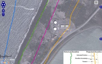
Online map plots coastal erosion in 8 Western Alaska locations
Each year, coastal communities in Western Alaska watch feet – even yards – of shoreline disappear into the waves. Now, a new online mapping tool will let them look at past erosion and see where coastlines might be in future years.