Listen to this story:
Climate change has caused winter in Alaska’s largest cities to warm more dramatically than in other major cities across the U.S. over the long term. But this winter in Juneau doesn’t match the overall trend.
Nicole Ferrin, the warning coordination meteorologist for the National Weather Service in Juneau, said that’s the difference between climate and weather.
“Climate is what you expect and weather is what you get,” Ferrin said.
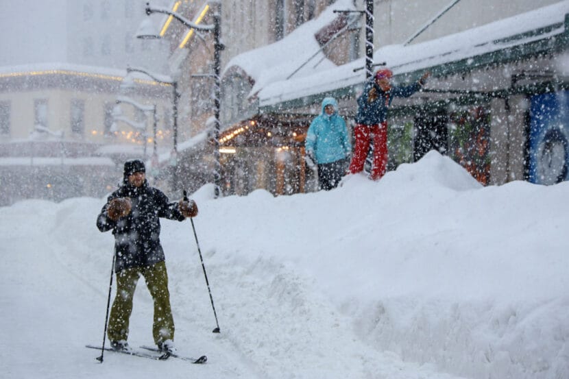
This winter, Alaska’s capital city has received more snow than Fairbanks and Anchorage combined.
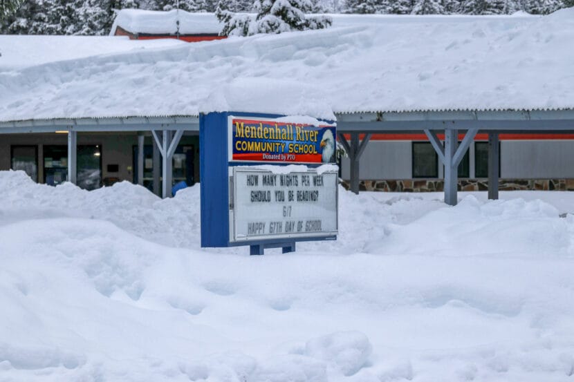
Juneau has received more than twice the amount of snow it gets on average. Typically, Juneau sees around 88 inches of snow. But as of March 19, 184 inches have fallen at the Juneau International Airport this season, and there’s more in the forecast.
This is Juneau’s third snowiest winter on record so far. Just a few more inches could move up that ranking. The winter of 1964-65 holds the record at 194.3 inches.
Juneau also experienced a temperature yo-yo between extended cold snaps and rapid warm-ups this winter. In the local climate record, Ferrin said the city had its second coldest December, a warmer-than-average January, and a roughly average February. Since record keeping began in 1943, this has been Juneau’s 26th coldest winter.
But Ferrin said looking at an overall average of the season misses the full picture of what happened this winter.
“The winter as a whole ends up appearing pretty normal, even though it definitely doesn’t feel normal, because we had kind of two extremes in there,” she said.
Anyone with a shovel can tell you this winter isn’t over. But over the long term, the season is getting warmer and less snowy in Juneau and in other places across the state.
Winter trends in Alaska’s largest cities
Climate Central, a nonprofit research group, analyzed 245 U.S. cities using daily average temperature data from NOAA weather stations. They found winters got shorter in 80% of the cities by an average of nine days. Juneau and Anchorage came in first and second for major cities with the most winter days that have warmed above average temperatures of the past.
Between 1998 and 2025, more than two-thirds of Juneau’s winter days rose above temperatures that were typical of winters between 1970 and 1997. In Anchorage, 55% of winter days were warmer than they used to be.
Climate Central calculated the historical winter temperature threshold — meaning the highest temperature at which it’s considered ‘wintery’ — at 29.6 degrees Fahrenheit for Juneau and 19.1 degrees Fahrenheit for Anchorage.
Kaitlyn Trudeau, a senior climate science research associate at Climate Central, wrote the report. She said that the season isn’t necessarily disappearing, it’s just not as cold as it used to be. Her goal was to find out by how much.
“The winters of the past — a lot of the winters that people remember when they were growing up — we are seeing much fewer days of those kinds of winters,” Trudeau said.
Trudeau’s analysis was based on a similar one by Brian Brettschneider, a senior climate scientist with the National Weather Service in Alaska. He reanalyzed the data over a call with KTOO.
Brettschneider’s analysis resulted in different numbers. His results show closer to a third of winter days have warmed in each city: 35 days in Juneau, compared to Climate Central’s estimated 62 days; and 26 days in Anchorage, compared to Climate Central’s estimated 49 days.
He said the main methodological differences were that he looked at an earlier period for the historical record, started with slightly higher temperature thresholds and smoothed out the daily average temperature data differently.
“In the areas where there are big changes, what can seem like trivial differences in the methodology can have outsized impacts,” Brettschneider said.
Neither analysis has been peer reviewed. But Brettschneider said that no matter how you look at the data, it’s clear that Alaska’s winters are losing their trademark chill.
Climate change is causing Alaska to warm faster than anywhere else in the country and it’s particularly noticeable in the winter. It’s called Arctic amplification and Brettschneider said it’s driven by melting sea ice and less snowfall.
“Snow acts like a mirror that reflects solar energy back out into space,” he said. “So with fewer days of snow on the ground, those days are notably warmer than they used to be. With less of the Arctic covered in sea ice, more of the oceanic warmth can be liberated to the atmosphere.”
According to NOAA data that Climate Central analyzed, Anchorage’s average winter temperature rose 4.6 degrees Fahrenheit between 1970 and 2025. In Juneau, the average rose 5.5 degrees Fahrenheit.
Since Juneau’s winter temperatures typically hover around the freezing point of water, a spike in temperature can quickly turn snow to rain.
A 2022 report by local scientists at the Alaska Coastal Rainforest Center found that snowfall in Juneau declined a modest amount between 1943 and 2020, and predicts that Southeast’s snowpack will decline significantly by the end of the century — by as much as 22% or even 58%, depending on the rate that humans continue to pump greenhouse gases into the atmosphere.
Update: This story has been updated with the snow total for the season and rank in the record as of March 19, 2026.
 (5)")