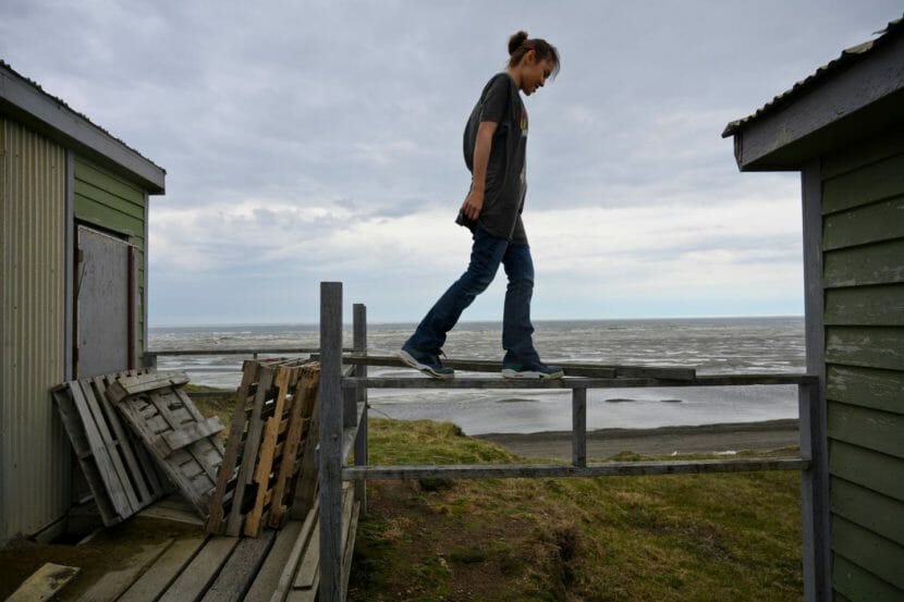
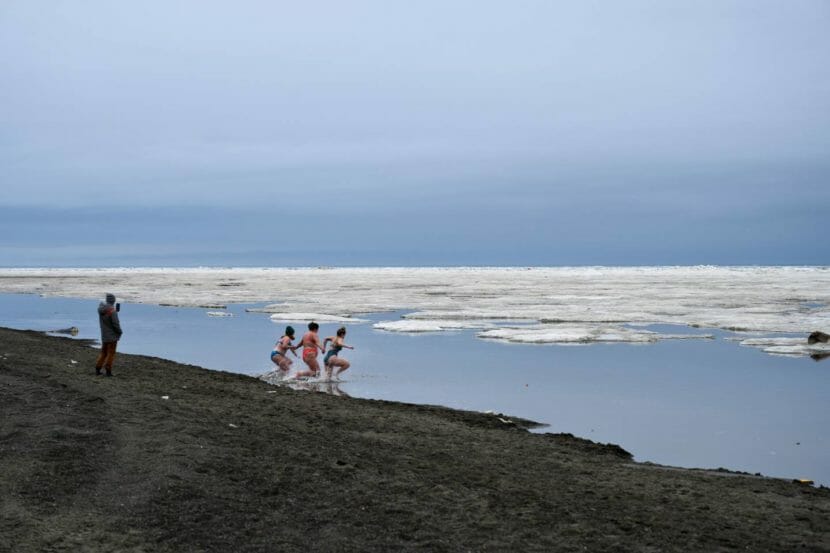
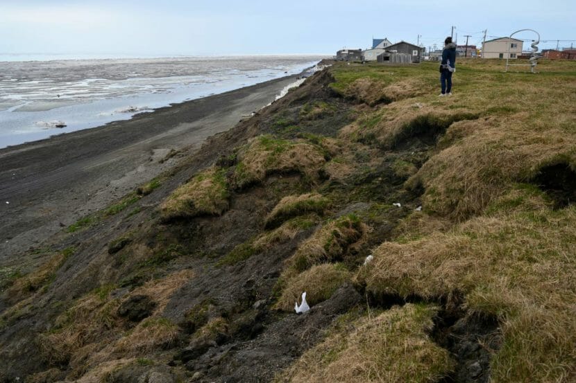
UTQIAĠVIK — Miranda Rexford-Brown walked atop the slowly disappearing sandy bluff between the Arctic Ocean and the house her father built. The late-June wind frazzled her hair as she looked out at the shore-fast ice and the approaching coastline.
“It gets our window wet,” Rexford-Brown said about the ocean. “And then the mist, it sprays our house.”
In Utqiaġvik, where the coast is eroding at some of the fastest rates in the nation, storms, flooding and thawing permafrost damage houses, roads and cultural sites. Ice forms later each year and storms are becoming longer and more severe.
To protect residents — as well as more than $1 billion worth of critical infrastructure, access to subsistence areas and historical resources — the U.S. Army Corps of Engineers is designing a 5-mile-long rock revetment along the coast and raising a road that follows the coast at the city’s northeast. The design for the first 0.75 miles of revetment is nearly complete and going through final internal reviews, said John Budnik, the Corps’ public affairs specialist for the Alaska District. A construction contract will likely be awarded before the end of the calendar year.
North Slope Borough Mayor Harry Brower said that building a seawall will help protect the city from coastal erosion.
“In a matter of years, we’ve lost a number of ice cellars, sod houses, we had to move homes that were aligned to the bank before,” Brower said, pointing to five houses on top of the bluffs at the south end of town. “All of these homes had to be moved.”
[Previously: Seawall planned for Utqiaġvik will help protect the Arctic Alaska city from increasingly extreme storms]
Rexford-Brown’s house was among those moved inland in the 1980s. Back then, the house was occupied by Rexford-Brown’s father, George Leavitt. During one storm, the ocean took out a big chunk of land beneath the house, and Leavitt needed to stay in Rexford-Brown’s apartment.
“Our back bedroom, there was nothing under there. The house was going,” Rexford-Brown said. “Pretty soon people were walking under our house.”
After waiting a few days for the storm to calm down, the borough and city employees came to move the house inland, equipped with a crane, tractor and two wide, flat tow ropes — “the kind (the community) uses to pull up the whale,” Rexford-Brown said. The city offered the family a piece of land near the Fred Ipalook Elementary School, to move their house even further inland, but Leavitt refused to relocate. He built this house from the floor up near the ocean where he could stay close to his family and the water.
“He said, ‘No way, I’m not leaving the beach,’” Rexford-Brown said. “We’ve already been here 60 years already. This is where we live. We were happy at home.”
After several houses on bluffs were moved away from the cliff, they are now located right against the road, which limits the amount of parking space available and leaves no place to relocate them farther inland.
“This is too close,” Rexford-Brown said, looking at her neighbors’ house near the edge of a cliff. “They don’t even got a walkway no more.”
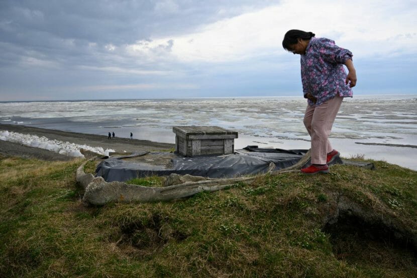
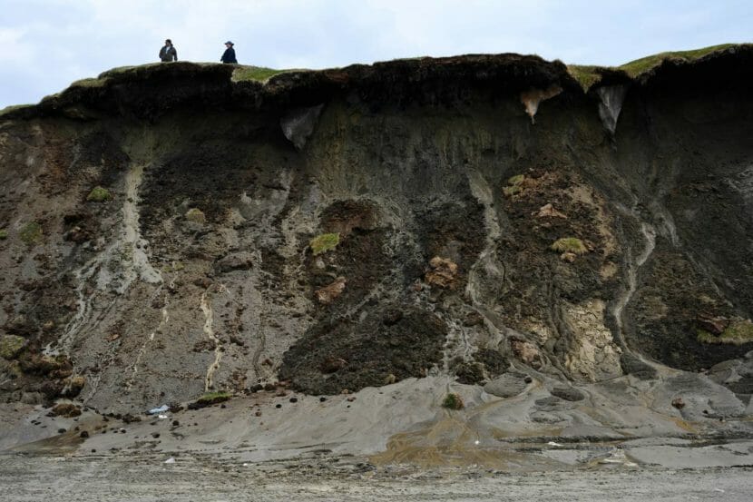
Just a few steps in front of Rexford-Brown’s house, she pointed out the slowly sinking ice cellar her neighbors still use to store meat and fish. The land around the cellar has been falling off, exposing its walls, and parts of the bluff seemingly hang above the beach.
The bluffs are not the only place affected by coastal erosion in Utqiaġvik. The storms — which are becoming stronger and more prolonged — also regularly damage Stevenson Street, which runs along the beach and connects the main part of the village to the residential area close to the Naval Arctic Research Laboratory and Iḷisaġvik College. The street can be washed out and “completely cut off everybody who lives out there,” as it almost did during a storm in 2017, said Scott Evans, deputy director of capital improvement program management at the borough.
[‘What choice do we have?’ As the Arctic warms, Alaska Inupiat adapt.]
If the storm waves reach the lagoon area, they could contaminate the only freshwater source in the community, according to the 2019 Barrow Alaska Coastal Erosion Feasibility Study by the Corps. Sewer infrastructure and an old military landfill are also close to the coast, and if they are damaged, engineers said, contaminants could harm people as well as birds and marine animals.
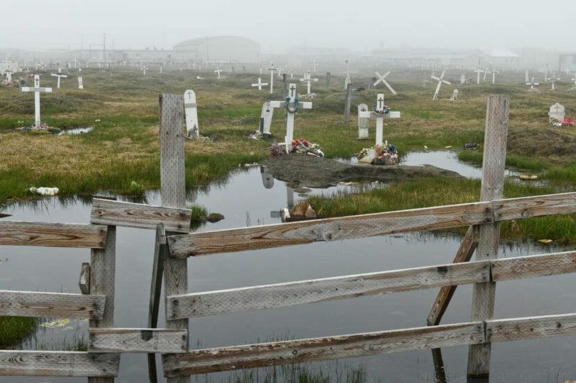
The graveyards inland have been affected by permafrost thaw, and historically important sites along the coast have been washing away, said archaeologist Anne Jensen. Eroding ground in Utqiaġvik holds sod houses, meat cellars and human and animal bones, she said.
[From 2015: Barrow’s eroding coastline reveals human bones at Ukkuqsi site]
“There’s literally everything people used,” she said. “Lots and lots of bones that tell all kinds of information about what people were eating and about those animal populations. … There’s a lot of stuff there, particularly deeper earlier stuff, that hasn’t necessarily been looked at at all.”
Archaeological discoveries suggest that the bluffs, where houses are now facing the cliff, used to be the burial sites, usually placed on higher ground inland — a sign of the coastline eroding for hundreds of years, Jensen said. Until the early 1910s, a larger community was located at Nuvuk, the tip of Point Barrow, before the site was completely abandoned.
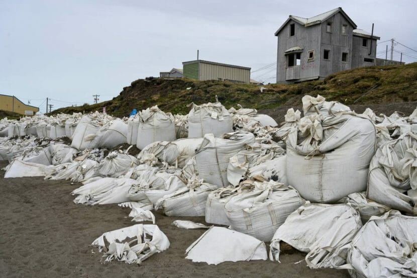
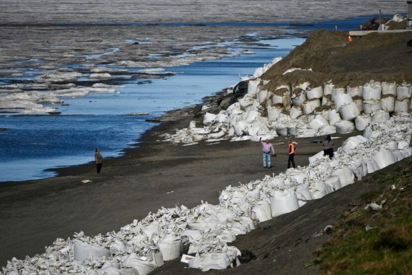
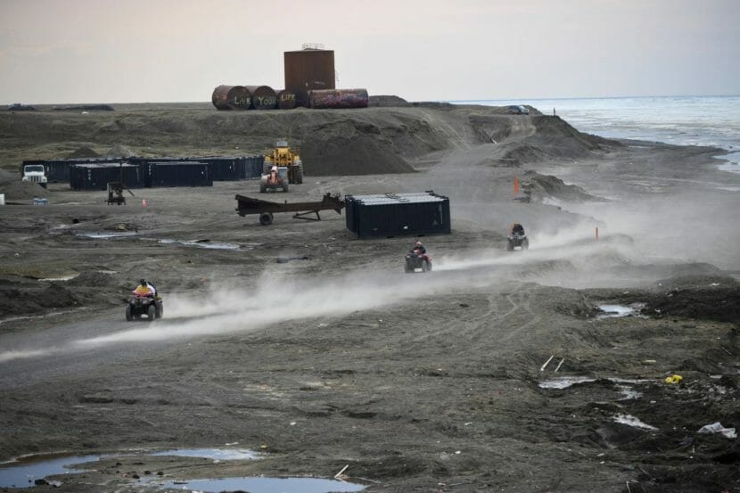
The borough works to minimize the risk of flooding and erosion and yearly bulldozes up beach materials into temporary beach berms, Evans said. Every year the borough spends approximately $8.3 million on emergency response and uses most of the local gravel for obstructing and maintaining the temporary berm along the coastline. They also work to make sure the larger sacks with gravel are at the base of these bluffs to reinforce the shore and stop wave action, Evans said.
Rexford-Brown looked down from the cliff to the shore at the row of white sandbags, placed for protection from the waves.
“They can help for a few days, I guess. But September 26, it’s bad, the waves are big,” Rexford-Brown said. “Sandbags, they are trying to help, and I can see they are. But easily, they can be taken overnight.”
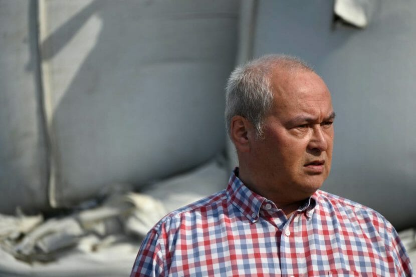
On the beach in Utqiaġvik in late June, Brower spoke to Sen. Lisa Murkowski about how the bluffs had collapsed since her last visit, and why moving forward with the construction of the wall is more urgent than ever.
“We’ve been communicating with Army Corps, we’ve been patiently waiting,” he said.
Over the course of the last decade, Corps engineers have been planning a two-layer rock revetment at the bluff area and the lagoon, stretching from the airport past Browerville and to the Naval Arctic Research Facility. In their design, they have been taking into account the behavior of the waves, melting ice, eroding land — and the need of whalers, fishermen and other residents to access the ocean. Budnik said that the seawall will maintain all access points to the water residents now have.
“The Corps of Engineers will work with project stakeholders when designing these features to ensure whalers and fishermen have access to the ocean,” he said.
In January, the construction of the Barrow Alaska Coastal Erosion Project in Utqiaġvik was fully funded with about $364.3 million from the Infrastructure Investment and Jobs Act.
“I’m looking at these guys and they’re probably thinking ‘I don’t have two years,’ not when you see how much has already crumbled away,” Murkowski said, looking at the houses on the bluffs.
“If you want to save the community, you want to save all this infrastructure, everything from the homes to the airstrip to your businesses, the utilities, everything that we’re going to be putting money into with this infrastructure bill. We can’t throw good money after bad by not making sure that this community isn’t literally washing away year over year over year.”
Utqiaġvik resident Robin Mongoyak said that the construction of the seawall is important to avoid the need to move coastal residents inland and to protect the city from strong ocean storms that sometimes surge inland.
“These past storms are little compared to what can happen suddenly overnight. A strong storm can take up to a week to subside, and by that time, a lot of infrastructure and land would be destroyed or underwater,” he said. “We may depend on our ocean for sustenance, but we must respect its nature.”
 (5)")