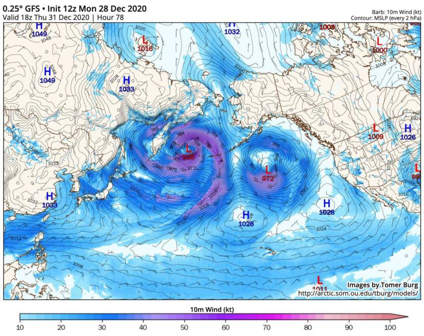
The collision of a warm, wet weather front with a mass of cold air from Siberia could set a new record: the lowest barometric pressure recorded in the North Pacific. That could mean hurricane-force winds and high seas in the southwest Bering Sea.
“This storm is generating a lot of interest from weather watchers around the world,” said climate specialist Rick Thoman of the University of Alaska Fairbanks.
He said the storm — which is expected to reach Unalaska by Thursday night — will be comparable to Typhoon Nuri in 2014, and to another record storm that touched down near Adak in 2015, causing wind damage in Unalaska and the Pribilof Islands.
Anchorage-based National Weather Service Climatologist Brian Brettschneider said current models show the barometric pressure plummeting to as low as 920 millibars on Thursday. The current North Pacific record low is 925.
That’s the kind of reading you would expect in a pretty strong hurricane in the tropics, said Brettschneider.
“You have the ingredients that could come together to have the storm kind of explosively develop,” he said.
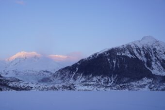
The places that could be hit hardest are western Aleutian islands like Shemya and Attu. But the heart of the storm could also center on the community on Adak, which has a population of about 100, and Atka, a community of about 50 people located 100 miles further east. National Oceanic and Atmospheric Association forecasts show winds up to 75 mph in Adak.
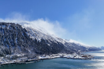
Thoman said it won’t be as severe in the more-populated fishing port of Unalaska.
“Because this storm is going to be very far west, like the 2014 ex-typhoon Nuri, we’re not expecting those kind of damaging winds to move into the eastern Aleutians or the Pribilofs. But you certainly will notice the weather front,” he said.
Low pressure will likely create more of a typical storm for Unalaska — short-lived 50 to 70 mph winds. Another effect could be waves as high as 40 feet in the western Bering Sea, said Brettschneider.
“That’s going to be a major issue for commercial fishing, for ocean transport. Those are some serious waves,” he said.
The system is caused by the convergence of a deep high-pressure cold front from Siberia with the warm, tropical low pressure from the South Pacific. Parts of Siberia have been recording temperatures in the minus-70s Fahrenheit, said Brettschneider.
“When you have cold air and warm air meeting together, it provides a lot of energy for the storms, for the low pressure to really deepen,” he said
Mainland Alaska likely won’t see any of the winds from the storm, but Brettschneider said there will be indirect effects. A low-pressure system in the Bering Sea will push a high-pressure system over the Yukon.
“It means we’re going to have an easterly flow which is going to bring colder temperatures. And so paradoxically, we may cool down, over the next week, in part because of that low pressure,” he said.
If the pressure does set a record, Brettschneider said, there won’t be any fanfare in the weather world other than the recording in the charts. But he said keeping track is still important.
“We’re monitoring the state of the climate regionally and globally and how these things are changing. And the intensity of storms is going to be a marker of the changing climate,” he said.