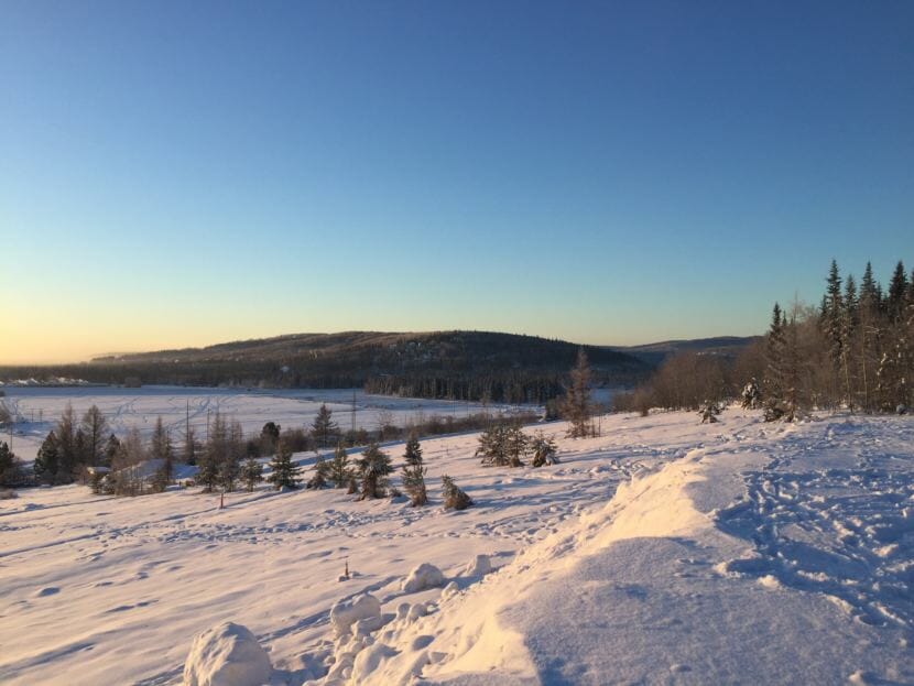
This week, some places in the Fairbanks area saw temperatures in the negative 30s and 40s Fahrenheit.
It only stayed like that for a few days — though more severe cold is predicted before the week is over.
Fairbanks’ cold snaps have historically been the stuff of legend. But due to climate change, and some other factors, they have become less frequent and less severe.
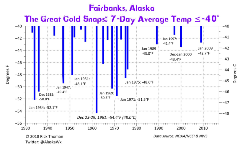
Mary and Dick Bishop arrived in Fairbanks in the fall of 1961. That December, Fairbanks experienced its most intense cold snap on record — averaging about -54 F for the last week of the month.
“Nothing’s bad after that,” said Mary Bishop, laughing. “We got quite an initiation.”
Over the past 50-plus years living in the Interior — most of it in Fairbanks — the Bishops have seen plenty of intense cold spells where it’s -40 F or colder for more than a week.
They said there’s a list of challenges that come along with that cold.
“Your tires are flat on one side,” said Dick Bishop, “and all the cars just didn’t start.”
“We had minimal insulation in (our) house,” said Mary Bishop, “and our young boys just lived in snowsuits.”
But the Bishops said those bottom-scraping temperature periods don’t happen nearly as often these days.
And they’re right, according to Rick Thoman, a climatologist at the University of Alaska Fairbanks.
He says that the definition of a cold snap is somewhat “in the eye of the beholder.” But when he mapped out the “great cold snaps” using the Fairbanks weather record, he defined it as a week where temperatures averaged -40 F or colder.
“Cold, like so many other environmental hazards in Alaska, is often cumulative,” said Thoman. “So one cold day, OK, you just get through it. But after several days of deep cold, as things start to really freeze up, the impacts grow,” said Thoman.
What he found was that over the last 80-some years, there’s been a noticeable change: The more recent cold snaps haven’t been as cold, and they’re occurring less frequently than they used to.
Thoman said a significant driver of that is climate change. But he said there are other factors too. One is related to urban growth, especially the increased number of cars on the road.
“Cars put out a lot of water just from burning gasoline, and that helps thicken up ice fog,” said Thoman. “And ice fog, believe it or not, is actually a pretty good blanket.”
That’s only a relatively small piece of it, according to Thoman, because when he looks at the data from other places in the Interior that have seen no population change, there’s a similar trend.
Another piece, he said, is natural variability — multi-decade cycles in the atmosphere and ocean that can be more conducive or less conducive to creating that super-cold weather.
But he added that even though those natural cycles have gone through at least one full rotation since the 1970s, “We have not see a return to the temperatures or the frequency of the cold snaps that we saw before that.”
The current forecast for the end of this week show lows in the -30 F to -50 F range in the Fairbanks area. Will it add up to a week cold enough to make it on Thoman’s graph of great cold snaps? Not this time, he said.
