Bonnie Herdlick was asleep when the 1962 avalanche peeled the roof off her house.
“It is a fantastic way to wake up at 5:10 with snow and glass in your face and a screeching wind, smothering with snow all over the place,” she wrote in a letter to family.
Halfway down the block, F.G. Nottingham thought he was waking up to an earthquake. His house jolted off its foundation, and one of the walls caved in.
Across the street, the Wilson family thought they heard an explosion. It was a flying tree trunk piercing their roof like a giant spear.
On March 22, the Daily Alaska Empire newspaper called the avalanche “freakish” — a perception that Herdlick shared.
“We really have always felt we were quite safe from snow slides at our end of the street,” she wrote. “We have slides all winter from the mountains so haven’t worried about them. We feel this was just a freakish wind.”
and Avalanche Research SLF)
But it wasn’t a freakish wind. It was “a major soft-slab avalanche with considerable powder blast damage,” according to the most complete history of the avalanche path behind Juneau’s Behrends Avenue.
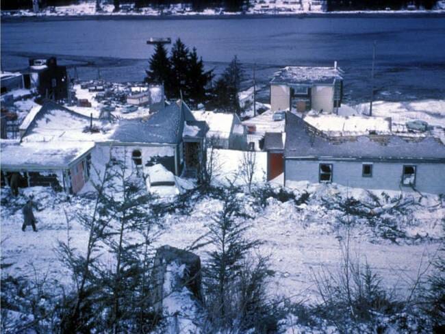
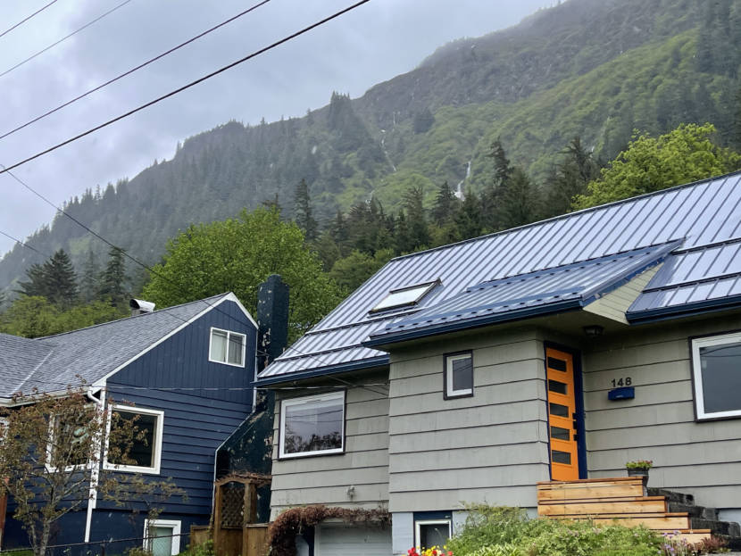
The dense part of the slide stopped short of the neighborhood — which was then a new subdivision at the base of the town’s namesake Mount Juneau — but the powder blast smashed chimneys and hurled chunks of them through roofs a block away. It splintered walls and blew out windows, plastering rooms with packed snow and broken glass.
More than 30 homes were damaged — seven of them severely, though somehow only one person was hurt.
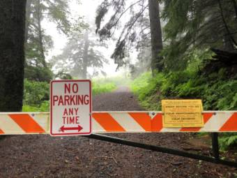
Fifty-nine years later — in February 2021 — Juneau’s emergency manager, Tom Mattice, went door-to-door at those same houses, advising people to evacuate. Mattice, who is also the city’s urban avalanche forecaster, had for the first time raised the avalanche danger level to “extreme” — the highest.
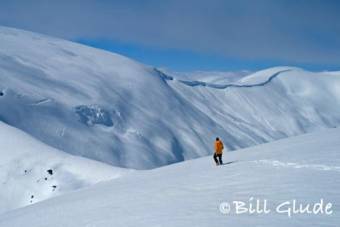
A series of storms had built up a slab of heavy snow on top of what’s called a persistent weak layer — snow that bonds poorly to the snowpack around it, making it more likely that what’s on top will slide. In the backcountry, Mattice had seen the aftermaths of recent avalanches that snapped trees up to 18 inches in diameter.
According to his forecast, conditions were right for a slab 4-6 feet deep to break free, potentially across the entire 1,599-foot width of the Behrends path. An avalanche that large could dwarf what happened in 1962, plowing through four rows of houses on its way down to the water in Gastineau Channel.
It didn’t happen. The snow eased off, the temperature cooled, and the unstable snowpack held until Mattice lowered the danger level to high.
“We may have dodged a bullet for the time being on the big one,” he wrote in his daily report.
The 1962 avalanche was what started the series of studies that helped make Mattice’s forecast possible. All of those studies agreed that the path can generate avalanches capable of leveling the neighborhood — and that such avalanches should be expected every few decades.
The authors of the most recent study, from 2011, described the risk to life and property as “unacceptable.”
“We hardly know — worldwide — of a hazard situation with such a damage potential and where no active protection measures were established,” they wrote.
‘Men report no danger’
There was no such consensus about the risk back in the 1940s and 1950s, as Juneau expanded out of its compact downtown, and the growing Highlands neighborhood spilled over into the avalanche path.
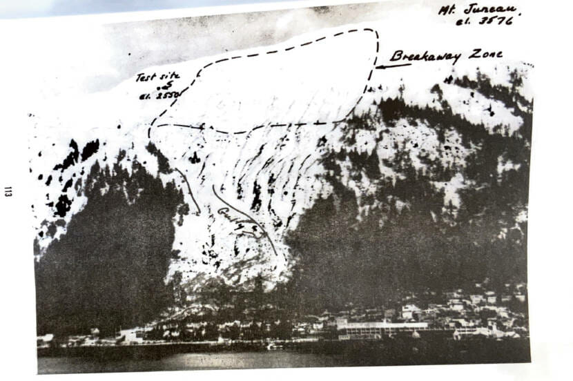
In March 1949, three men — Juneau’s mayor, city engineer and school superintendent — went over to Douglas Island to survey the avalanche path from across Gastineau Channel. The school district needed to build a new elementary school, and they’d selected a site at the very bottom of the avalanche path, where the Breakwater Inn stands today.
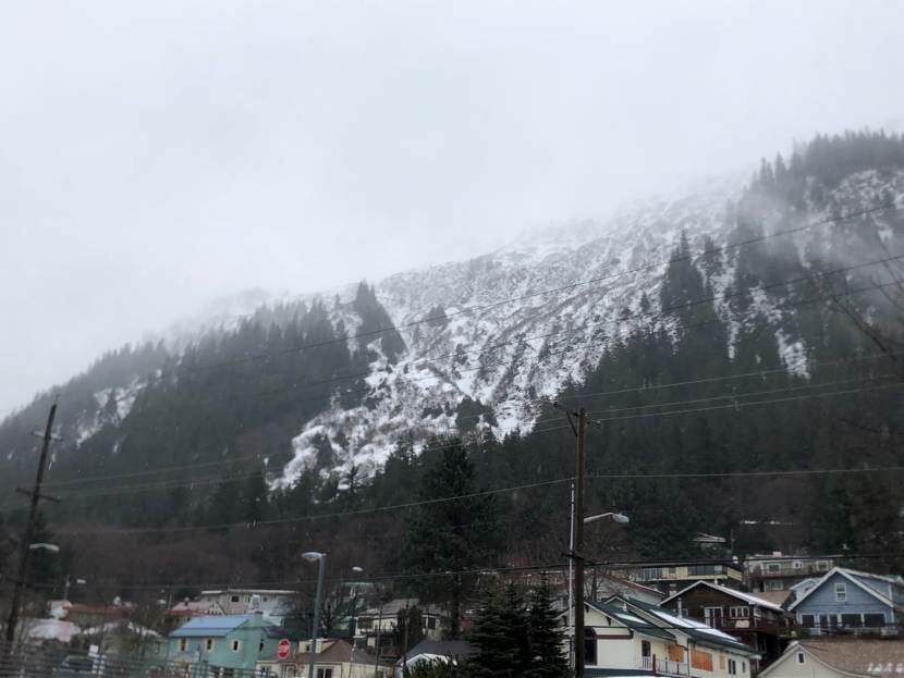
From across the water, the path would have looked then much as it does now in March: A huge, gradually narrowing vee of white mountainside, stripped bare of the dark spruce trees nearly to the base of Mount Juneau. The mountainside is laced with slide paths, but the Behrends path is the largest by far. The snowfield at the top, which avalanche experts call the starting zone, covers about 60 acres.
The largest known avalanche on the Behrends path came down in 1890, but we know little about it – not even the date. A manager of the A-J Mine had a photo showing its aftermath. He showed the photo to a U.S. Geological Survey scientist named W.S. Twenhofel, who years later described it to avalanche expert Keith Hart, who wrote the first real hazard study on the Behrends path in 1967.
The photo itself is lost, but Twenhofel reported that it showed hundreds of tons of snow piled up on the road — possibly where Glacier Avenue is now — and that the slide had plowed all the way through to the channel.
There are also accounts of a smaller slide in 1917 that blocked the road with debris but didn’t make it to the water.
Steve Gilbertson worked as a planner for the City and Borough of Juneau from the 1970s until his retirement in the 1990s. He remembers hearing stories about slides that big, before the neighborhood went in.
“I do recall talking to some old timers in town when I first got here that can remember, as kids, going to school and going out in the spring to picnics at Norway Point and having to climb over an avalanche,” he said. “So there was a history of slides coming down, you know, to Glacier Avenue.”
It’s not clear if the men surveying the proposed school site knew those stories, and you can’t judge the destructive potential of an avalanche path by just looking at it. The biggest slides happen infrequently, and over time the forest grows back along the sides and bottom of a path. Unlike other natural hazards, evidence of avalanches often melts away, making it hard to know just how big the worst slides might be or how often to expect them.
The city and the school district came to different conclusions about the Behrends path. Eager to get his school built, the superintendent planted a favorable report in the Alaska Daily Empire. It was titled: “Three Inspect School Site; Men Report No Danger.”
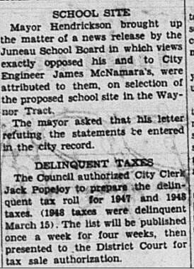
But neither the mayor nor the city engineer had approved it or even seen it before it ran.
A few days later, a rebuttal appeared in the Alaska Sunday Press under the headline, “Mayor Hendrickson Disclaims All Responsibility For Report Made On School Site In Waynor Tract.”
In it, the mayor said the site should be considered “a possible slide area.” The mayor and engineer felt that it was “unwise to put too much confidence in the holding power” of the forested area at the bottom of the path.
The city rejected the school site. Although rudimentary, their inspection was the first hazard study of the Behrends path — and the first time the city sought to regulate construction there.
Which sets up a perplexing mystery. Just seven months later, the same city council voted to expand Juneau’s city limits to annex the Highlands, including the spot where the school would have gone and the even more exposed slopes above it. The explosion of residential construction that followed left Juneau with the problem it lives with today: dozens of homes built in even riskier spots than the rejected school site.
‘The best we can with what we have’
The avalanche danger was not discussed — or at least no such discussion was recorded — when the city council voted on Oct. 14, 1949 to annex the Highlands. The vote was unanimous, and the annexation only rated a short paragraph in the next day’s paper — far less space than a report on water rates.
Juneau’s housing stock had not kept up with its population, to the point where minutes from a February 1949 meeting noted that “persons are having to turn away on account of the housing conditions.” The next year, the council officially declared a housing shortage and extended its rent control program.
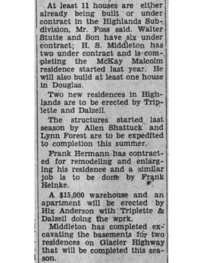
The city tried to keep up partly by encouraging apartment construction and partly by expanding to allow new residential development. In April of 1949, the Alaska Sunday Press noted that “people interested in financing home construction are the most numerous on record” and described 11 homebuilding projects underway in the Highlands, with more lots being cleared.
It’s not surprising that people were willing to move into the slide zone. Sara McBride, a disaster researcher with the U.S. Geological Survey, says when there’s conflicting information about a hazard, optimism tends to take over — and factors like Juneau’s housing shortage and even the physical beauty of the Highlands neighborhood may have driven that outlook.
“I think one of the things we struggle with a lot is optimism bias,” McBride said. “We all kind of walk around thinking, something might happen to someone else, but it’s not going to happen to me.”
There were also financial interests behind the push to develop the Highlands. The architect Harold Foss, who built many of Alaska’s best known public buildings including Juneau’s city hall, airport and public library, appeared in newspaper articles as an advocate of the expansion and in council minutes as someone directly involved. The Juneau Realty Company and Lemon Creek Sand and Gravel both bought and developed lots prior to the annexation.
And the newspaper acted as a cheerleader.
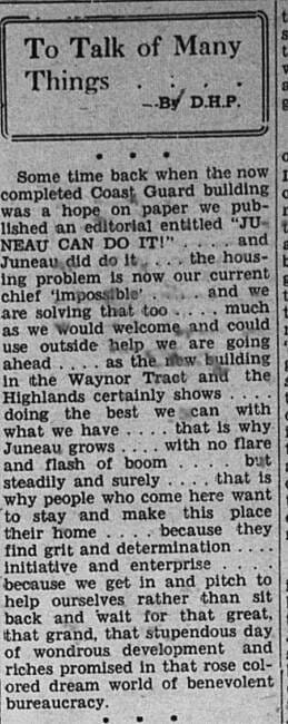
“The housing problem is our current chief ‘impossible’,” read an August 1949 column in the Alaska Sunday Press, “and we are solving that too. Much as we would welcome and could use outside help, we are going ahead. As the new building in the Waynor Tract and the Highlands certainly shows, doing the best we can with what we have.”
After annexing the Highlands, the city poured resources into developing the neighborhood. In 1950, the city shared the cost of building concrete sidewalks, extended the city bus route and built Parks Street to improve access to Behrends Avenue. Water mains went in along Behrends that summer, and in September the city called for bids to put a sewer line on Highlands Drive.
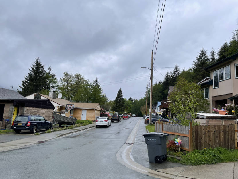
In the late 1940s, there were just a few houses in the avalanche path, on Glacier Avenue. But by 1950, the neighborhood was really taking shape. About two-thirds of the homes on the 200 block of Behrends Avenue were built that year. They all lay in the avalanche path.
‘At least to Egan Drive’
The last house on the block went up in 1959, only to be severely damaged in the avalanche three years later. While residents and the newspaper called the avalanche a freak occurrence, for the city it was a reality check.
Gilbertson, the former planner, says the 1962 slide was a turning point for Juneau because it led to the first real study of the path, completed in 1967, which in turn led to safer development.
“That was really the first step that gave the planning commission tools to prevent more land from being subdivided in avalanche areas,” he said.
More studies followed, each using more sophisticated methods to estimate the magnitude of the hazard and propose what could be done about it.
All of the reports agreed that no protective structure could be built that would stop or deflect the largest avalanches — the only way to make the neighborhood truly safe was to remove the houses.
The most recent study, prepared in 2011 by the WSL Institute for Snow and Avalanche Research in Davos, Switzerland, may be the bleakest. The authors’ modeling led them to recommend widening the severe hazard zone and extending it further downhill, “at least to Egan Drive,” which is the highway that runs along the water’s edge.
And unlike some of the earlier reports, the 2011 report sees building structures to deflect avalanches or stop them from starting as an unwise use of resources.
For example, the 1967 study found that building a system of 20-foot tall barriers and diverting dams would “probably reduce the hazard to tolerable levels.” The 2011 report dismissed the proposed barriers as “far too small.”
A 1968 study suggested building a massive, 100-foot-tall catching dam above the neighborhood. The 2011 report found that even that would not protect Behrends Avenue from powder snow avalanches like the 1962 event.
In the end, the 2011 report concludes — as others had before — that the most effective way to address the hazard was to get the houses out of its way. The report’s main recommendation was to seek federal funding for a voluntary buyout program. The report even ranked the homes in the path in the order that they should be bought out, according to their exposure. Such a program would mean people could leave the neighborhood if they wanted to, without selling to someone who was willing to move into it.

and Avalanche Research SLF)
‘The single most valuable asset’
Juneau’s government never actively pursued a buyout program. And there was little interest from residents.
“I don’t think that the consensus of the assembly was for city staff to put time on that,” said Sen. Jesse Kiehl, who represents Juneau in the Alaska Legislature. He was a member of the city assembly at the time. “Juneau’s housing market was, if anything, more pinched than it is today, and there was concern about whether those federal grants or others would help replace the number of units lost.”
So Juneau’s perpetual housing shortage, which put the neighborhood there in the first place, helps keep it there decades later. Kiehl sees no easy solutions.
“A home is the single most valuable asset most Americans will ever own in their lives,” he said. “It’s a really big deal. You have to balance that against people not dying. But you have to handle it very carefully.”
To McBride, the disaster researcher, it’s no surprise that a buyout program never took shape.
“Governments take drastic action and move communities,” she said. “However, they tend to happen after tragic events.”
Without the will or support to move people out of the avalanche path, Juneau has focused on stopping more people from moving into it.
Changes to the city code mean people living in severe avalanche areas can’t build anything that would let more people live on their lot, like a new bedroom or a mother-in-law apartment. The city has also persuaded several landowners to donate or sell unbuilt lots in avalanche paths to the city, to be maintained as open space.
In other words, because the problem of the existing neighborhood has proved intractable, most of the effort has gone toward keeping things from getting worse.
But Gilbertson says even those basic measures were hard to push through and sometimes failed.
“There were discussions about having a hazard disclosure on property records so that somebody buying a house might know that it was an avalanche area,” he said. “But that met a lot of public resistance because of the impact it would have on property values. And as a result, it was up to buyers of property to do their own due diligence.”
‘A very different way of looking at land use’
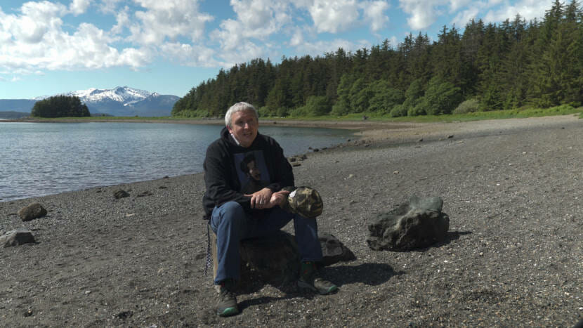
Sorrel Goodwin, a librarian at the Alaska State Library, says there were good reasons why the Áak’w Kwáan people chose Auke Bay — about 10 miles up the coast — as the mother village. Auke Bay had beach access, milder weather and a good lookout point.
In the summer, people would go over to the area that’s now downtown Juneau to fish, but in winter they left it alone.
Goodwin’s Tlingit name is Yashkanda.ets’. He’s L’eeneidí from Yaxté Hít. He says the people living at Auke Bay would have been perplexed to see newcomers “building in an area that very frequently in the wintertime gets hurricane force winds — we now call them the Taku winds — and is underneath several avalanche chutes as well.”
“It’s just a very different way of looking at land use, community planning,” he said. “I think it’s done very differently in an Indigenous context, versus a more industrialized, mechanized Western settler context.”
Those earliest planning decisions — made when people were building a mining town, not a capital city — have caused some of the mistakes of the past to seem baked in.
When the first report on the Behrends path came out in 1967, the city council kept it under wraps for more than a year. When the borough planning commission finally got their hands on it, they didn’t know what to do, either. It was a new way of thinking about their jobs.
One member thought they should condemn the threatened properties and clear the area. Another suggested keeping public buildings out of the runout zone. The problem quickly snowballed in their minds: If they were going to make rules for avalanches, what about rock slides? Tsunamis?
Any action they took in the avalanche path would have implications for Juneau’s other hazards, which are everywhere. The stakes were high — and they remain high for anyone seeking to make policy decisions about Juneau’s avalanche risk today.
All the homes damaged by the 1962 slide are still there today. After 50 years of studies, the city’s avalanche forecasting has been the main safety improvement. It’s the difference between possibly having a chance to evacuate rather than waking up, as Bonnie Herdlick did, to the sounds of shattering windows and splintering wood.
Paige Sparks and
Alaska’s Avalanche Capital
This story is part of a KTOO series about Juneau’s urban avalanche risk.