Listen to this story:
Ships could pose a risk to seabirds migrating through Alaska’s waters. Researchers mapped where ship traffic overlapped with bird traffic to pinpoint areas where flocks are more likely to smack into vessels, a phenomenon called “bird storms.”
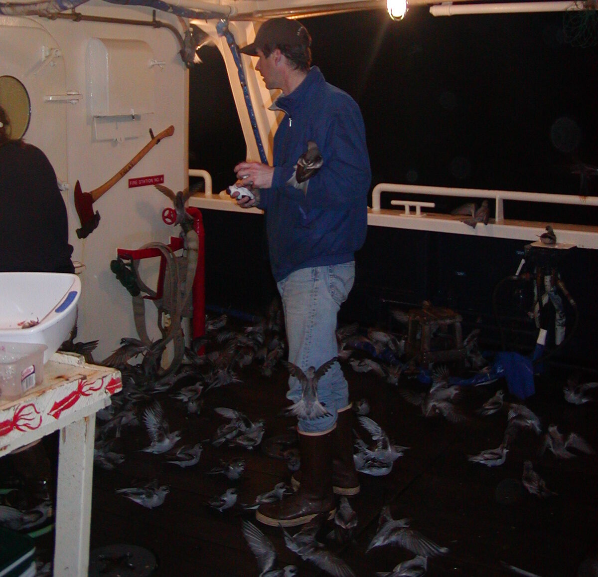
In the early 2000s, a group of researchers got caught in a bird storm. Jeff Williams was retrieving fishing nets on a research vessel in the Aleutian Islands when, suddenly, hundreds of fork-tailed storm petrels descended on the scientists.
Williams leads the Alaska Maritime National Wildlife Refuge at the U.S. Fish and Wildlife Service. The refuge spans waters from the Inside Passage through the Aleutians and north to the Chukchi Sea.
“It was around one of the breeding colonies, and we had to have the lights on to retrieve the nets,” he recalled. “It was one of these foggy nights, birds just come flying in.”
The birds seemed attracted to the ship’s lights like moths to a flame. So the scientists shut them off. Then they blew hair dryers to warm up the dazed, wet and cold storm petrels before releasing them. It was autumn, so many of them had just fledged their nests.
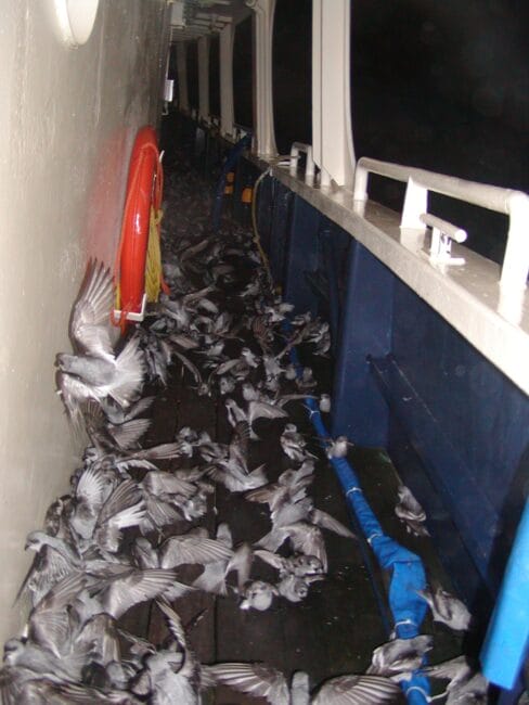
He said the birds fluttered down onto the boat and not many of them died. But other flocks aren’t as lucky.
“Some birds like eiders … larger waterfowl, they’re flying really fast. If they have a collision with a boat, they’re going so fast that they probably die,” he said.
Williams said these so-called ‘bird storms’ happen multiple times a year in the Aleutians, especially when massive colonies gather to feed and breed.
But he said there isn’t much data on how many birds actually die when they interact with boats in Alaska’s waters, or how often that happens.
A paper published in the journal Conservation Biology last month made a first attempt at assessing the potential risk to birds by mapping where they are most likely to interact with vessels in much of Alaska’s waters from the Gulf of Alaska, through the Aleutian Islands to the Arctic.
Williams said the findings track with what he’s experienced and plenty of anecdotes he’s heard.
“We’re kind of in the early periods of just recognizing some of that — what’s going on,” he said. “We know it happens. Even on vessels that try to do the right thing, it still happens.”
The researchers overlapped seabird observations from the North Pacific Pelagic Seabird Database between 2006 and 2022 with Automatic Identification System data, which tracks large boats. The analysis included about 1.3 million bird observations and 1 billion vessel location pings from thousands of boats.
Kelly Kapsar, a postdoctoral researcher at Michigan State University, crunched the data and made a risk score from zero to 100 based on the overlap.
“If it’s zero, no seabirds there, no vessels,” she said. “One hundred was the maximum amount of seabirds and the maximum amount of vessels that we saw.”
She found bottlenecks where that overlap was highest, and two spots jumped off the map: Unimak Pass and the Bering Strait. Auklets, shearwaters and northern fulmars were most exposed to vessel traffic in these areas.
Unimak Pass is a narrow pathway through the Aleutian Islands notorious for its frequent bad weather and ship wrecks. It’s one of the primary routes for cargo ships traveling between Asia and North America, and oil tankers moving south from the Arctic. The Bering Strait separates Russia and Alaska and is an important international pass for ships heading for the Arctic Ocean.
Marine traffic is increasing. As the climate warms, some productive fisheries are shifting north and Arctic sea ice is melting, opening up the high latitudes for longer periods.
The International Maritime Organization established areas to be avoided through Unimak Pass and the Bering Strait in an effort to reduce ship wrecks and damage to the environment. But there is no guidance for where or when crews should adjust ship lights to avoid attracting birds.
Ben Sullender, the director of geospatial science at Audubon Alaska and one of the authors of the paper, said these passageways are vital for millions of migrating seabirds. He suggests measures ships could take to try to avoid them.
“Make sure that that light is aimed at the deck where you need it, not up into the sky where it can draw in birds from a much further area,” he said. “There’s other things like changing the wavelengths of the light,” since some birds can be attracted to higher-energy wavelengths on the light spectrum like blue, green and ultraviolet.
But he said this research is simply a first stab at seeing where the overlap could become a conservation problem. The study doesn’t identify any actual impacts of vessels on birds, he said, since there wasn’t enough data to analyze that statewide.
The analysis also did not include Southeast Alaska due to data gaps, but the research team is hoping to make similar maps for the region in the future.
