After more than a year, Juneau has resumed discussion of landslide and avalanche hazard zones with the introduction of a new draft ordinance.
The proposed land use code considers the adoption of new hazard maps and possible limits on development in hazard zones.
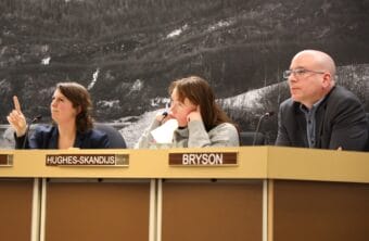
In a planning commission work session on Tuesday, Jill Maclean, the city’s director of community development and one of the authors of the ordinance, laid out its central challenge.
“It’s the balance over property rights and life,” Maclean said. “And you and the Assembly have the responsibility of trying to find that balance. And I frankly don’t envy you.”
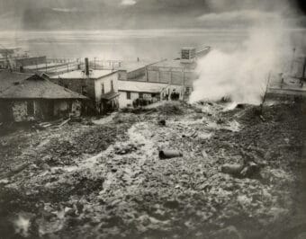
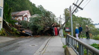
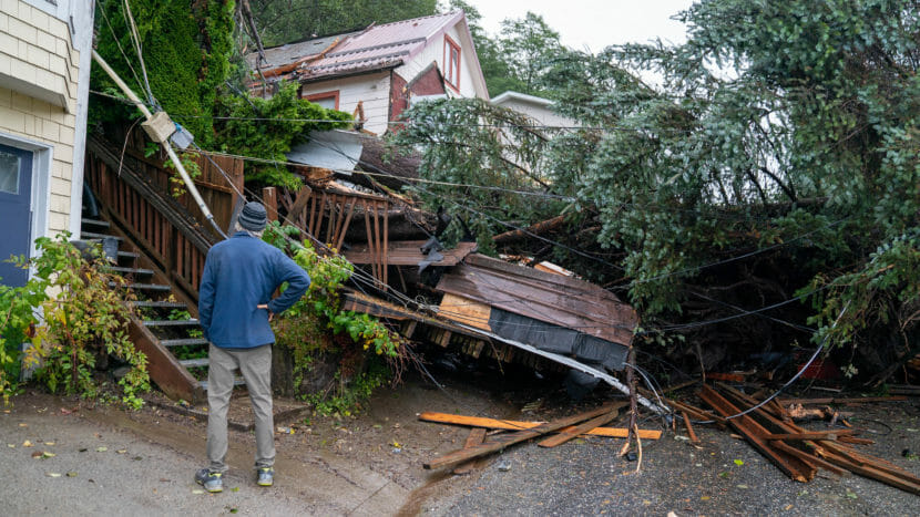
The debate over what the city should do to address avalanche and landslide hazards downtown has spanned several decades. But the introduction of new hazard maps in 2021 brought the topic to light again.
Those maps, which were commissioned to replace the city’s maps from the 1970s, place half of the structures downtown in moderate to severe hazard zones.
Now, the city assembly will have to decide how to regulate the new zones. The draft ordinance at this stage only considers the “severe” zones – the areas with the most imminent risk of an avalanche or landslide event.
The new ordinance differs from the existing land use code in some key ways. For one, it proposes new disclosure requirements, which would require property owners to provide a written notice of hazards to renters or new potential buyers.
During Tuesday night’s meeting, some doubted whether it should be the city’s role to inform specific buyers or renters. Others, including planning commissioner David Epstein, expressed support.
“I think we have a duty to inform,” Epstein said. “We have an obligation to let people know, hey, this property is a severe landslide or avalanche area. Period.”
Even if the disclosure requirements stick, Maclean said the city has no plan to make that code enforceable.
One major sticking point of the new ordinance will be the distinctions between avalanche and landslide zones. While the city’s older maps combine the two, despite their different risk factors, the new maps separate them.
That sparked debate about whether to regulate severe landslides and severe avalanche zones in a similar way. Much of that discussion focused on expanding properties to fit more people.
Avalanche events are generally more predictable, while landslides can happen sporadically, over long timescales. And they have a wide variety of causes. Maclean said that makes them harder to regulate.
“It’s difficult. I think it’s probably one of the most difficult ordinances in the land use code,” she said. “Given the sort of infrequency or frequency, however you choose to look at it, of these types of events.”
In many ways, the scope of the new maps is limited. They outline the zones where landslides are possible, even likely, but they cannot give an idea of the timing or magnitude of events. And because of that uncertainty, deputy chair of the planning commission Mandy Cole said the city should hesitate to limit property rights.
“We don’t totally understand risk yet,” she said. “And so the idea that we could then make policy decisions that will impact homeowners now and in the future, feels perhaps presumptive.”
The city has no plans to expand research on avalanches and landslides locally.
The debate over the new ordinance will continue in the next committee meeting before it is presented for public comment later this spring.
Correction: A previous version of the story misidentified the deputy chair of the planning commission.
 (5)")