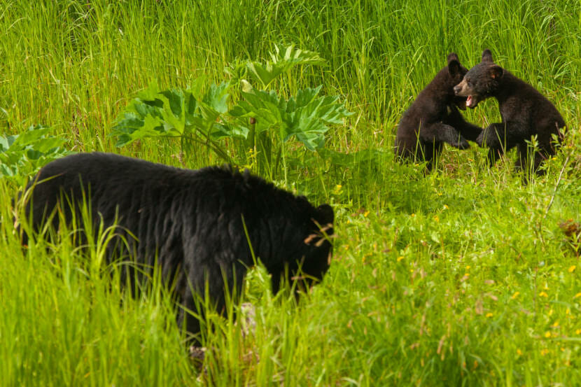
Juneau’s Mendenhall Wetlands make up the third largest tidal salt marsh area in Southeast Alaska. The wetlands are considered key habitat for hundreds of species of shorebirds and migratory waterfowl, and an essential spawning ground for salmon and other fish.
“It’s an extraordinarily important piece of habitat that we often take for granted,” said Matt Robus, a longtime Juneau resident and retired director of wildlife conservation for the Alaska Department of Fish and Game. “Because it’s right in the middle of our town.”
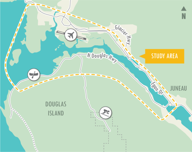
Now, scientists and local conservation groups are raising concerns about possible threats to the wetlands from the long-discussed second crossing to Douglas Island. A study for the project outlined eight possible locations for the crossing, and half of them pass through the Mendenhall Wetlands State Game Refuge.
The second crossing has garnered widespread community support, but Robus says he’s been unhappy with route planning so far.
“There has not been, in this first stage of the process, a lot of display or consideration of these biological values,” he said.
Robus belongs to a new Mendenhall Wetlands study group, made up of about 20 local scientists and naturalists. The group aims to protect the wetlands, which have already lost around 40% of their original expanse, from further development.
“There’s already pressure on this habitat, and there aren’t other habitats around like it to replace it,” Robus said. “Our concern is that it really shouldn’t be subjected to another significant negative impact. And these crossings have at least the potential to do that.”
Some of the possible crossing locations could reverse mitigation efforts tied to existing development around the wetlands. The Southeast Alaska Land Trust owns more than a dozen parcels of wetlands that were conserved to offset the airport expansion. Two of the proposed alternatives either border those parcels or cut through them.
Krista Garret, the land trust’s conservation director, says they’re not opposed to the idea of a second crossing, but they believe it’s possible to build a route that won’t disturb the wetlands.
“As the study moves forward, we encourage a focus on alternatives that are outside of the refuge boundaries,” she said.
The existing alternatives provide three options further out in Gastineau Channel, closer to the existing Douglas Bridge. Those routes would avoid the refuge.
An infusion of federal money and an omnibus spending package approved earlier this month will fund further studies on the possible environmental impacts, as well some of the project’s preliminary engineering.
From there, the preliminary study will continue to narrow down alternatives, with a final recommendation sometime next year. If the city decides to proceed with crossing, those recommended routes would go through a more robust environmental review under the National Environmental Policy Act.
The public comment period for the preliminary crossing alternatives ends Feb. 3. Comments can be submitted online.
 (5)")