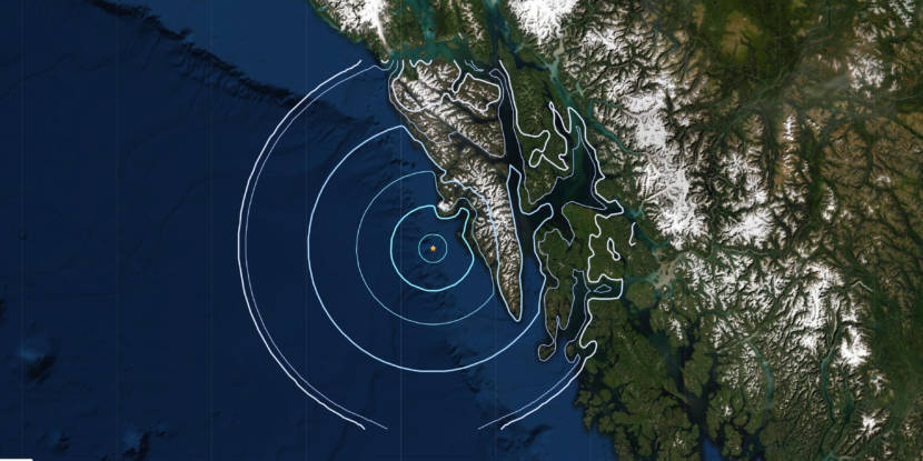
A magnitude 4.3 earthquake struck about 30 miles southwest of Sitka shortly before 1:30 p.m. Monday.
The earthquake’s epicenter was around 15 miles deep. According to a statement from the National Tsunami Warning Center, there is no tsunami danger associated with this quake.
Natalia Ruppert, a seismologist with the Alaska Earthquake Center in Fairbanks, said the earthquake occurred on the Queen Charlotte Fault.
“We don’t detect smaller earthquakes [on the fault] because it’s farther away. Usually it has to be magnitude 3 so that the sensors on land are able to detect it,” Ruppert said. “But larger earthquakes are not as common. Last time we had a significant earthquake on the Queen Charlotte Fault was 2013.”
The earthquake in January 2013 was a magnitude 7.5, located about 70 miles south of Port Alexander. That earthquake triggered a tsunami warning, forcing Sitkans and residents of surrounding communities to evacuate to higher ground, but only minimal sea level shifts were reported. More recently, Sitka and most of coastal Alaska went under a tsunami warning in January 2018 after a 7.9 magnitude earthquake rumbled deep in the Gulf of Alaska.
Ruppert asks that residents of Southeast Alaska who felt rumblings Monday afternoon to report them to the Alaska Earthquake Center’s “Did you feel it?” webpage.
