Twice a year a review panel that advises the National Oceanic and Atmospheric Administration, or NOAA, on its marine and coastal mapping programs meets to talk about what’s next. In late August, they met in Juneau and talked about Alaska’s priorities and a developing focus on the Arctic.
The Hydrographic Services Review Panel took public comment on each day of their meeting and heard from business community and members of the public who use NOAA’s maps and charts to get around.
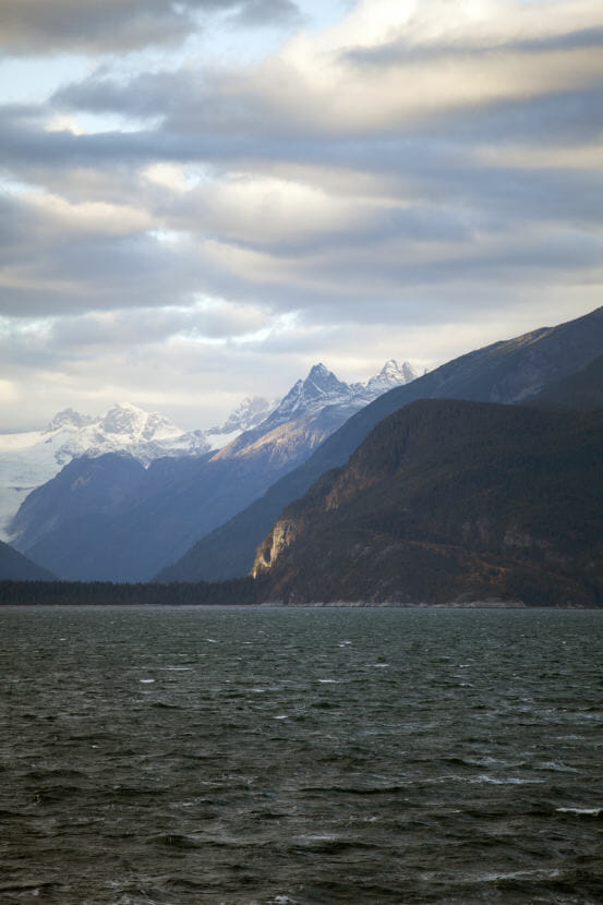
Every summer, tour operators take boatloads of sightseers along the coastline of the Kenai Fjords National Park.
There are these moments that the guides are looking for — when someone spots a bear or a colony of sea lions or when they motor up to a glacier. The captains slow down and they drift closer.
It’s this type of interaction with nature that plays out over and over again with tourists in the state. But captains have to be cautious.
“There’s a lot of local knowledge required to work these places,” said Kenai Fjords Tours Marine Operations Manager Eric Simpson.
In a business where the whole point is to get close to the shoreline — accurate nautical charts, maps of the sea and the shoreline are hugely helpful.
And, in some places in the Kenai Fjords, like Aialik Bay — Simpson said the charts just aren’t detailed enough. There, the tidewater glacier has changed a lot since the last time it was charted. Now there are reefs and shoals that don’t appear anywhere on the nautical charts.
“You know, it’s not necessarily that the information that’s there is wrong, it’s just that it’s not complete,” Simpson said. “There’s places where the water is deeper than the chart would indicate. Places where there are rocks that stick out further than the chart would indicate. ”
For boaters who don’t know the area, relying on the charts could cause an accident.
And, this is a problem for a lot of Alaska. The state has more than 40,000 miles of mappable coastline.
There are a lot of data gaps. Places where the maps haven’t been updated for decades. Or, in the case of the U.S. Arctic, places where the mapping data was last updated in the 1800s.
It’s NOAA’s job to provide the charts, maps and tide tables that sailors use to navigate the nation’s waters. And twice a year, a group of marine navigation and mapping experts meet to talk about NOAA’s navigation goals.
At the meeting in Juneau they focused on Alaska and the Arctic. They talked about everything from surveying the Arctic to moving away from paper charts to monitoring coastal erosion.
The meeting gave people like Simpson with Kenai Fjords Tours the opportunity to weigh-in on what they think those priorities should be.
The panel also heard from tug and barge operators, cruise ships, the fishing community — the people who make up what’s called the blue economy.
“You hear the buzzwords of ‘blue economy.’ But what does that mean for Alaskans?” said Fugro Alaska General Manager Rada Khadjinova.
Fugro is a geoservices company that gathers and processes mapping data all over the world.
She said Alaska’s mapping backlog — both land and sea — is daunting. But, she is focused on coastal mapping.
“I mean, we are a state that relies on resource development,” she said. “When an operator is looking to site a mine or to explore new area — say ANWR — the coastal component is a must.”
It’s not just an economic necessity. The panel also heard from stakeholders in Alaska’s coastal communities who rely on coastal maps for subsistence fishing.
Khadjinova said the addition of a rapidly changing Arctic adds thousands upon thousands of miles of areas that need to be explored and mapped.
So far, NOAA said it has modern maps of just over 4 percent of the U.S. Arctic waters.
 (5)")