The satellite used to record sea ice data in the Arctic malfunctioned in April, and scientists are scrambling to calibrate a month of missing data.
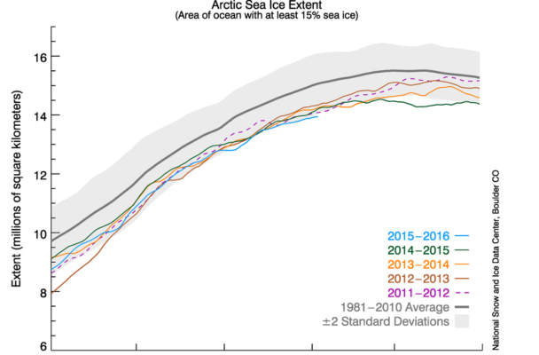
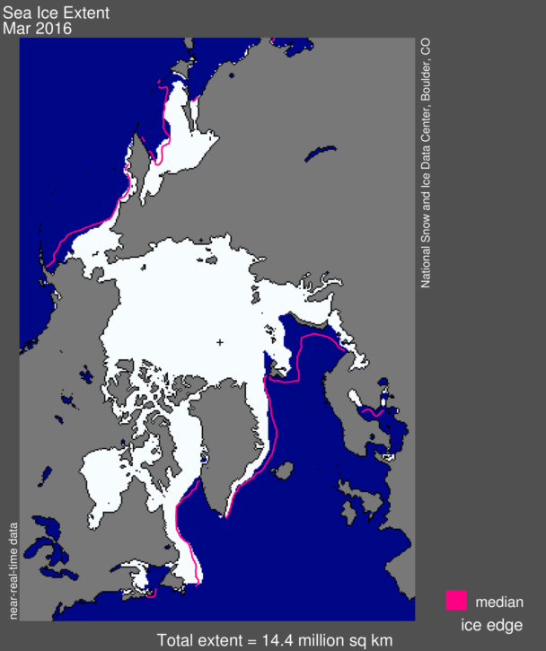
In mid-March, the National Snow and Ice Data Center reported the lowest maximum sea ice extent in satellite history.
“It was a record low in our satellite record, which is quite consistent,” explained NSIDC lead scientist Ted Scambos. “We work on it a lot to make sure we can compare it, one year to the next.”
NSIDC first started recording sea ice data in 1978.
Julienne Stroeve is an NSIDC scientist who studies sea ice conditions in the Arctic. Stroeve said she and her fellow scientists noticed a glitch in their data in early April.
“We started getting false ice concentrations in parts of the Arctic where you wouldn’t have sea ice,” Stroeve explained, “so it was biasing our extent.”
“The good news is they’ve found another satellite in that same type of series,” confirmed Amy Holman with the National Oceanic and Atmospheric Administration. “They believe the data (are) compatible enough that we can continue the data record,” Holman said.
The satellite Holman is referring to has been recording sea ice data for a year now, which Julienne Stroeve said should be enough time to cross-calibrate. Consistency is key, Stroeve said.
“You want as long of a data record as possible to really see how much this change we’re seeing is due to natural climate variability, for example, or how much is due to anthropogenic warming.”

To help make that distinction, NSIDC captures an image of sea ice extent in the Arctic every day and posts daily updates online. The agency has since suspended the updates and removed all of April’s data from NSIDC’s archives.
While the malfunction was a bit of a shock, Stroeve said it was bound to happen.
“It wasn’t surprising that this happened because the satellite was pretty old,” Stroeve said, “so eventually the sensors do degrade and start giving bad data.”
The satellite that malfunctioned was launched 10 years ago. The one they’re relying on now was launched nine years ago. Stroeve said there is a backup to this backup, but that one is still on the ground.
“Congress took away the funds for the Air Force to launch it, which is very unfortunate,” Stroeve said. “Obviously, we’re hoping that pressure can be put on Congress to launch that other satellite.”
For now, Stroeve and her colleagues will continue cross-calibrating data, with the hopes that the one they’re using now will stay online until Congress approves funding for the next series of satellites.
