Searchers in Washington are using bulldozers and bare hands to work their way through debris at the scene of Saturday’s mudslide near the tiny community of Oso. At least 24 people are believed to have died.
As The Seattle Times reports, geological studies have warned for decades that the area of Snohomish County, where Oso is located, was at risk for landslides.
“We had a very wet March. So rainfall is one of the things that drive landslides. But there’s other things that may contribute as well,” David Montgomery, a geologist at the University of Washington, Seattle told NPR’s Audie Cornish. “In this particular case, there was a history of previous sliding at the site. And once a hill slope has slid, it’s vulnerable to further sliding, because the material that makes up the slope is weakened.”
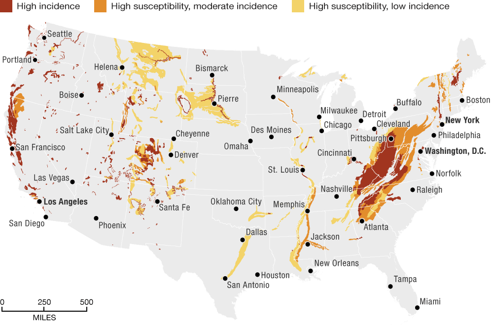
Other areas of the country are at risk for similar incidents. The U.S. Geological Survey maintains information on incidence of, and susceptibility, to landslides. The map below, using the group’s most recent data from 2001, shows areas of the continental U.S. that USGS rates as most susceptible to landslides.
9(MDEwMjQ0ODM1MDEzNDk4MTEzNjU3NTRhYg004))
Read original article – Published March 26, 2014 2:30 PM
Map Warns Of Patches Susceptible To Landslides
 (5)")