
A massive landslide, estimated to be around six-and-half miles long, near Glacier Bay has scientists in New York clambering to get to Southeast. The slide happened Tuesday morning, and was discovered by a local pilot.
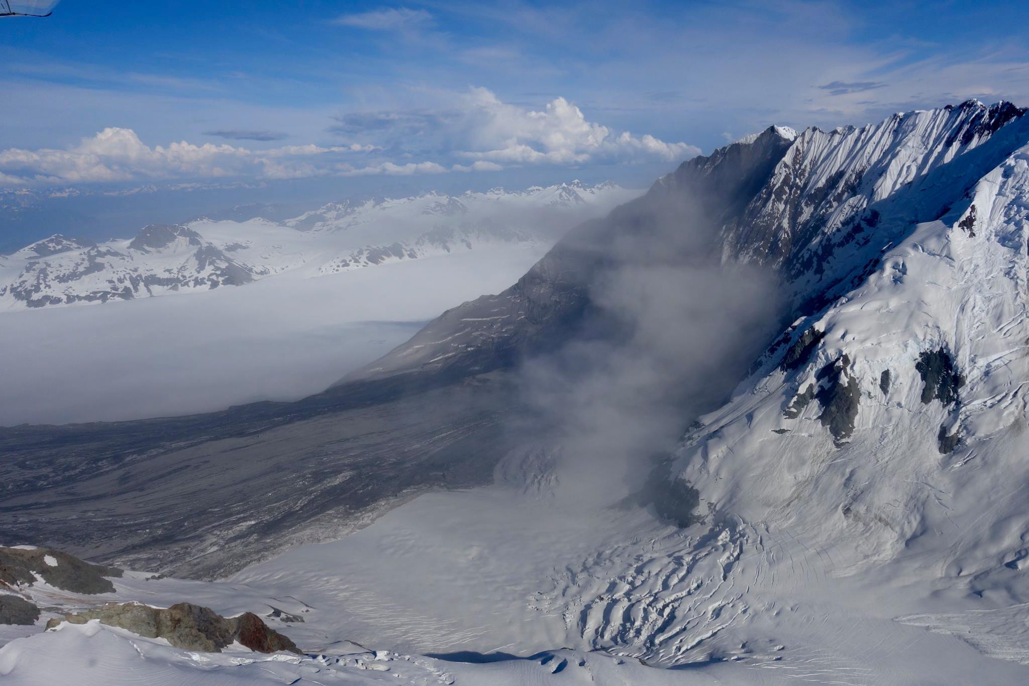
On Tuesday morning, when Paul Swanstrom saw the dust cloud hovering over the Lamplugh Glacier, he said he knew what it was immediately.
“You bet because we’ve seen these landslides before,” he said. “It made the air a little dusty, but it’s not any danger, no.”
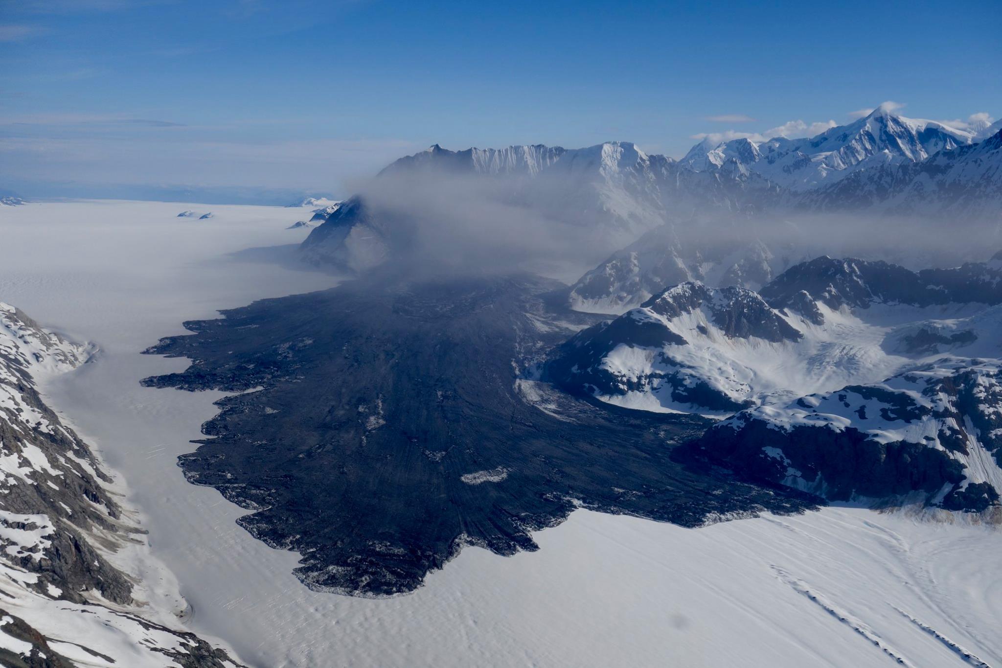
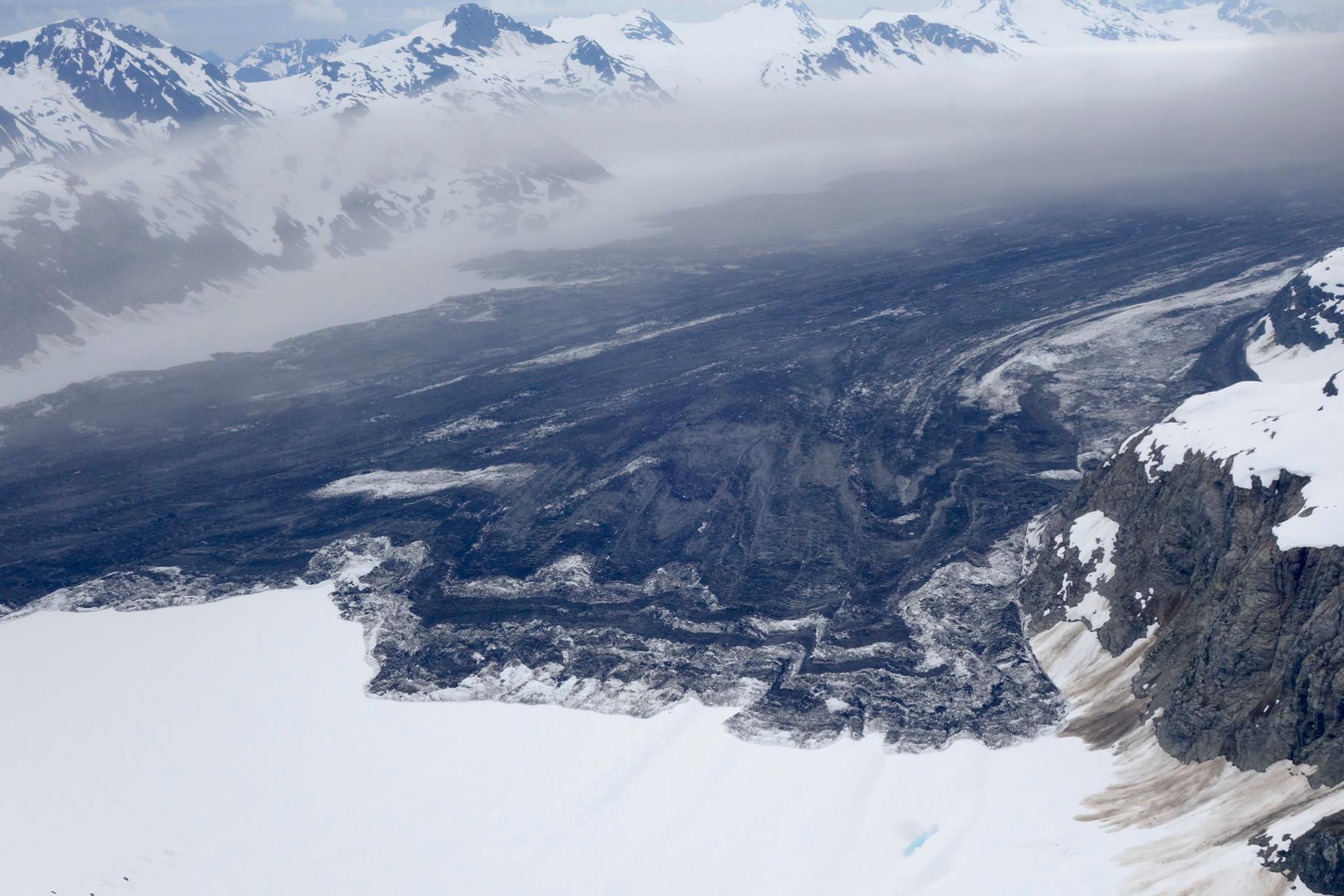
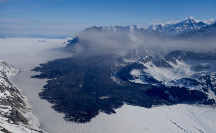
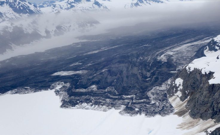
This landslide in Glacier Bay National Park, like the ones in 2014 and 2012, sent millions of tons of debris spilling down the mountainside. According to the Alaska Earthquake Center it happened at 8:21 a.m. Swanstrom flew over it about two hours later.
Tuesday’s slide toppled down the glacier for approximately six and a half miles, though the official size is still unknown. But early estimates rival the giant Glacier Bay slides in the past several years. It may have even been the biggest yet.
“The other one, a couple, four years ago, that was really big went down about four miles, four and a half miles, and it was in a narrow canyon,” Swanstrom said. “This thing is longer and much bigger in many ways.”
The recent avalanche happened about eight miles from those big slides that excited scientists in the recent past, Swanstrom said, and about 60 or so miles from Haines.
“This is a very important event,” said Colin Stark, a research professor with the Lamont Doherty Earth Observatory at Columbia University.
He’s getting ready to fly to Juneau and head to the site to gather sediment samples in the coming days. Measurements and samples will give Stark and his team a better understanding of the why the slide happened, and how exactly it traveled to its final resting place.
“We have events like this maybe three to five times per year across the entire world. And the St. Elias Range, and Glacier Bay – Southeast Alaska in general – are hotspots for rock avalanches, or very large landslides.”
The reason, he said, is that mountains in Southeast are growing at an accelerated rate because of shifting tectonic plates.
“So, mountains are being built very fast and they’re also being destroyed very fast because the rocks are weak and glacial erosion is very powerful,” Stark said.
The result is an extraordinary amount of rock avalanches of impressive magnitudes.
From his initial data, Stark thinks this slide likely has a mass of around 150 million metric tons – a world-class event, he said. As far as the force of the slide, it was 280 giganewtons, which, let’s face it, is meaningless to most of us. So, Stark tried to put it in a context better grasped by the average person.
“I think a small SUV weight about a ton. I’m not very good on the real-world things, I’m an academic, what do I know? But, 100 million cars falling down a slope,” he said.
Stark said the abundance of these slide events in Glacier Bay is concerning because of cruise ship traffic and remote lodges scattered throughout the area.
“And in fact, these rock avalanches do seem to occur more in summertime, possibly related to warmer temperatures, although that’s a little hard to say. They don’t happen often enough for us to be able to generalize — yet. This is a very serious event. I want to say it’s one of the largest in the last few decades.”
Stark and his fellow researchers detect large slides with the help of long-distance seismometers. They knew about this one “very quickly” after the slide let loose.
“So, we can be based in New York and look at the local and global seismographic network,” he said. “My colleague has an automatic system for detecting regular earthquakes based on these instruments that are spread around the globe. But occasionally, these seismometers pick up a very, very large landslide.”
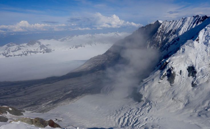
Haines geologist Russ White flew over the slide the day after it happened. He said earth-moving events happen fairly frequently.
“Geologically speaking, they happen all the time, you know, two and four years is fairly frequent,” White said. “Mountains are eroding constantly, and this is just one of the forms of erosion. It’s a fairly spectacular form of erosion when a 4,000-foot face of a mountain falls off and shoots itself six miles out across the glacier. That’s pretty spectacular.”
As of Friday afternoon, the Alaska Earthquake Center had yet to compile data on the landslide, so they didn’t have a number, or magnitude. But, they said, it’s obvious this is a very significant event that is much bigger than anything in the recent past.
Seismologist Michael West said the signals from the slide were clear all the way up to Barrow, across to Nome and beyond. He said this slide “shook a decent amount of our planet.”
 (5)")