A landslide warning system developed in Sitka is now available to the public as an online dashboard, and work is underway to export the project to other communities in Southeast Alaska.
The dashboard was unveiled at an Aug. 17 meeting of the Sitka School Board Wednesday.
Lisa Busch is the director of the Sitka Sound Science Center, which spearheaded the project. Busch is a 35-year resident of Sitka, and landslides were not on her radar until a very bad day seven years ago.
“This project got started in 2015, when we had a deadly landslide that killed our friends and family,” Busch said. “And I can say that I’ve been here 35 years and just never thought about landslides until then. As a big worry, mostly, we worried about tsunamis. And all of a sudden people had lots of concerns and lots of questions.”
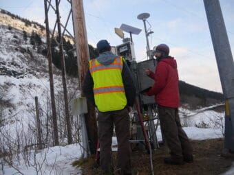
What emerged from that disaster was an interdisciplinary research program funded by a $2 million grant from the National Science Foundation. Partners included NOAA, the USGS, the RAND Corporation, which did social science, and the Sitka Tribe of Alaska, which gathered oral histories.
In all, there were 30 scientists and university researchers on the team. Busch said the final product had to serve a unique purpose: to give people enough information about if and when to act.
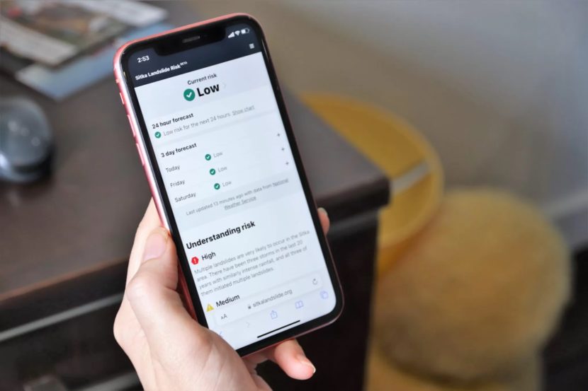
“And people said to us, and I think this is very Alaskan, they wanted to make their own decisions,” Busch said. “They wanted a digital dashboard, where they could go and look at the risk and then make their own choices about if they should evacuate.”
Landslides result from cumulative factors, and some areas are much more at risk than others.
“We looked at where the more landslide prone areas are,” Busch explained, “and what part of Sitka is really most prone to landslides. And by the way, it’s not the whole town — it’s about 10% of our community. So when the landslides first happened, everybody said, ‘Well, we’re all in a landslide zone.’ That’s not true.”
The dashboard shows low, medium and high risk, and generates a curve based on current conditions — plus the forecast — to anticipate risk up to three days into the future. It’s got recommendations on how to evaluate the information based on where you live and what you should do if you decide to leave your home.
It’s still being fine-tuned. Emergency planners hope to create messaging to help residents manage landslide risk moving forward.
“What the emergency response people would like is for you to find a buddy — a buddy system,” said Busch. “So my house is close to the water, and so I’m more prone to being hit by tsunamis. And my friend’s house is someplace else where I can go when there’s a tsunami warning. And then when there’s a landslide warning, my friend can come down to my house and be in my safe house. We’re saying go uphill for tsunamis, downhill for a landslide.”
Sitka is just the beginning for what Busch hopes becomes a regional landslide warning system. Work is already in progress to create similar warning systems in Hoonah, Skagway, Klukwan, Craig, Kasaan and Yakutat.