Update — Dec. 1, 3:00 p.m.
The high wind warning issued for Juneau has expired, but the National Weather Service says there will still be strong winds gusting late Tuesday night and early Wednesday morning.
Meteorologist Caleb Cravens said peak wind gusts of 60 miles per hour blew down a tree near the airport and caused a power outage early Tuesday morning.
Wind gusts also topped out at 52 miles per hour in the Mendenhall Valley and 45 miles per hour at the downtown harbors.
Two inches of rain fell at the airport in 24 hours, while 3.6 inches fell in Douglas and 3.52 inches fell in downtown Juneau.
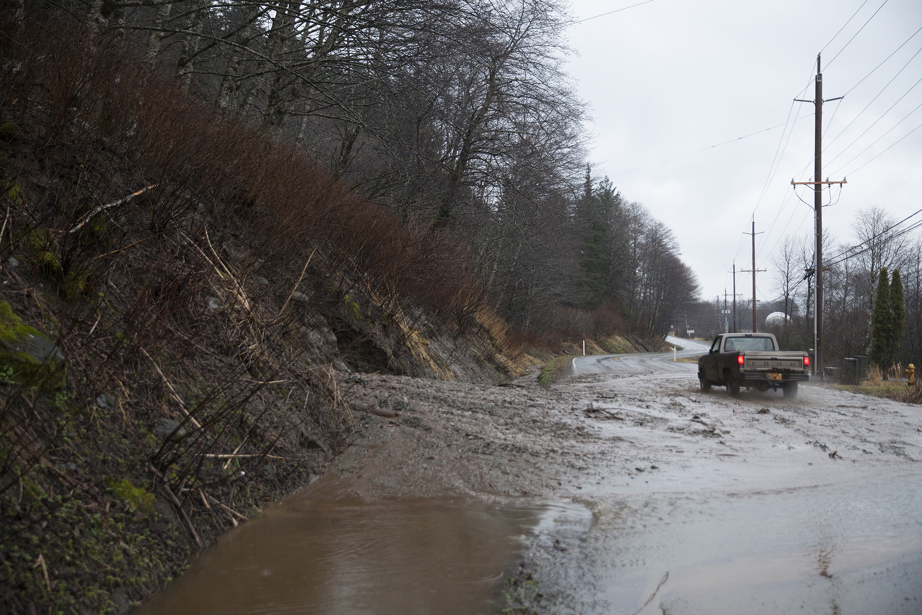
A flood advisory is in effect for the Juneau area. Cravens says water levels in Jordan Creek and Montana Creek are near minor flood stage and could cover a parking lot or a roadway.
Original story
As much as ten inches of rain could cause flooding and mudslides in the Juneau area this week.
The National Weather Service has issued a flood watch for Juneau that starts Monday evening and runs through Wednesday night.
Meteorologist Caleb Cravens says an atmospheric river, or a low-pressure system, will pick up warm moisture from the southern Gulf of Alaska and dump it on the eastern gulf and the Southeast Alaska Panhandle.
Along with the heavy rainfall, wind gusts are expected to top 45 miles per hour in Juneau.
“When you have winds like these and heavy rains, it increases the potential for trees falling down as the winds are blowing hard on those and you have saturated soils,” Cravens says.
Mudslides are usually caused by saturated soils. Capital City Fire/Rescue is asking people who live or recreate on hillsides to be ready for extreme weather and have a plan for evacuation on short notice.
Instead of passing through quickly, Cravens says the storm system will be “sticking around for a while.” Heavy rainfall is expected to last into Thursday.
The snow level will eventually rise to 5,000 feet, melting a lot of the snow at higher elevations like at Eaglecrest Ski Area. That will add to water levels in creeks, streams and rivers.
The City and Borough of Juneau’s Docks and Harbors Department is encouraging boat owners to check their boats, confirm their mooring lines are secure and their pumps are operating correctly, and make sure all that rainfall is not collecting in their vessel over the next several days.
Busy weather coming to SE AK!!! There are 3 watches in effect: Winter Storm Watch, High Wind Watch and Flood Watch across different part of the Panhandle. Check out: https://t.co/TEmJGpIQje for details. #akwx .@KHNS_FM .@KTOOpubmedia @ravenradio .@KFSK1 .@KSTKradio .@800KINY pic.twitter.com/Yv8mBfqfDa
— NWS Juneau (@NWSJuneau) November 30, 2020
