Update: the flood warning that was in effect has been cancelled
Scientists are currently watching an area next to the Mendenhall Glacier above Juneau.
Several years ago, what was a little-known natural event there caught everyone by surprise. Mendenhall Lake and Mendenhall River below the glacier were flooded, and a popular recreation area and riverside homes were threatened. Since then, the flooding has repeated several times.
Could it happen again this year?
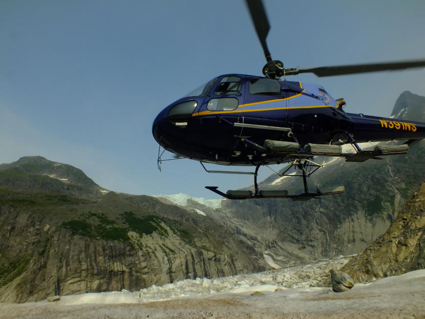
Our helicopter banks into a turning descent above Mendenhall Glacier. Gigantic, undulating swells and mounds of ice ripple as far as the eye can see. Bad things can happen if we land on a slippery, uneven surface and just turn off the engine.
This is my introduction to a “hot offload.” The pilot touches the helicopter’s skids onto the ice, but keeps the rotors going for what is essentially a supported hover. She waits for us passengers to hop out with our gear. We crouch down on the ice as the noise and rotor wash beats down on us from above. A thumbs-up to the pilot, and she takes the helicopter up like a rocket.
By comparison, it’s now virtual silence out here on the ice. The only other sounds I hear are a large, distant waterfall, a nearby stream and the two scientists I’ve tagged along with. They are Aaron Jacobs, a hydrologist with the National Weather Service, and Christian Kienholz, a research assistant professor at the University of Alaska Southeast who specializes in glaciology.
“So, he’s the hydrologist and I’m the glaciologist, which is ideal here,” Kienholz said.
We’re near the origin of a recent phenomenon called a jökulhlaup, which is an Icelandic word used to describe a glacial dam release.
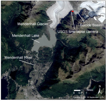
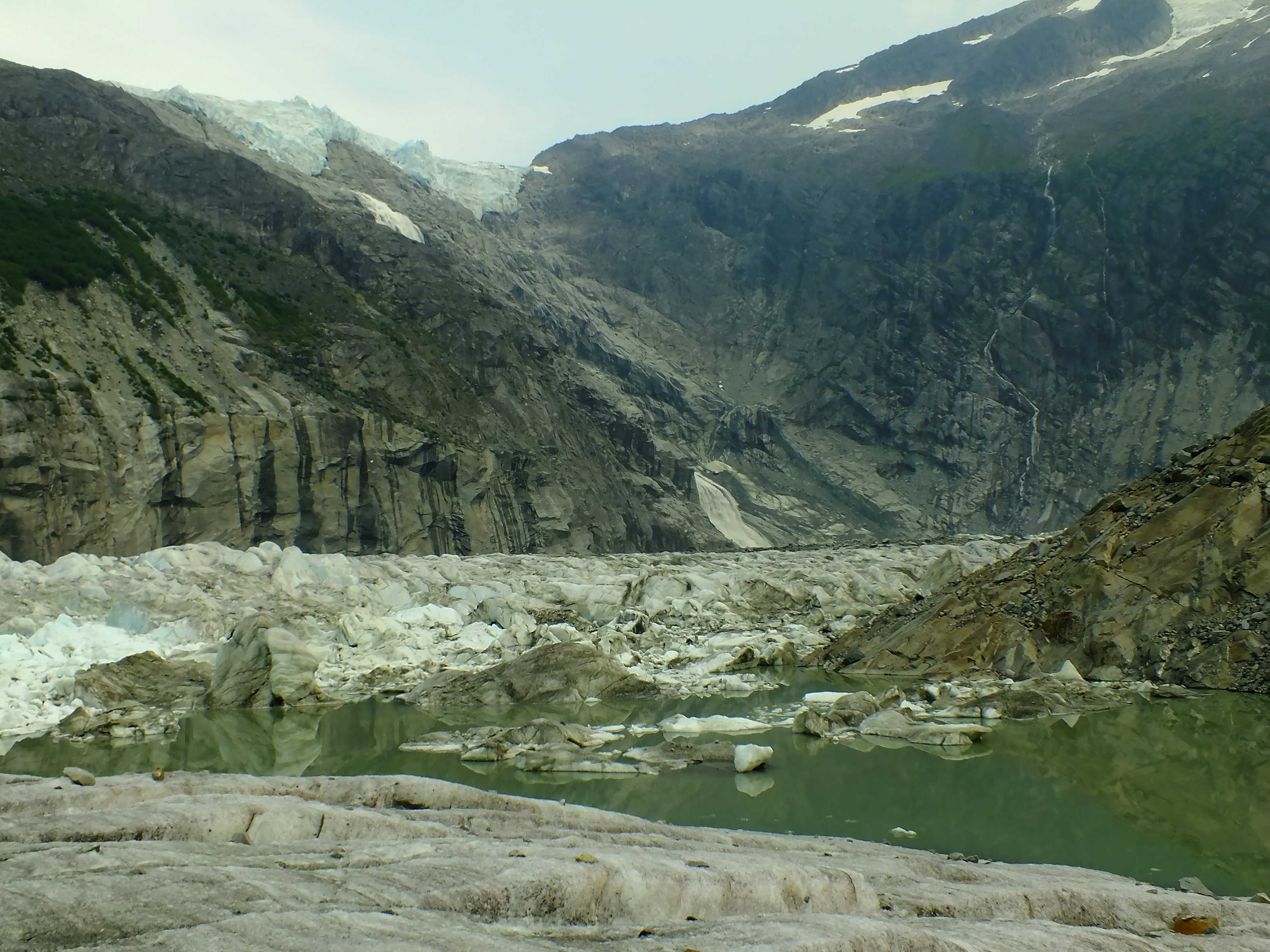
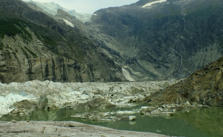
The source is Suicide Basin — a giant, steep-sided, ice-carved valley adjacent to the glacier. Suicide Basin is so big that you can fit inside as many as a hundred copies of the Great Pyramid of Giza.
Kienholz said meltwater from the Juneau Icefield accumulates in the bottom of the basin every summer.
“What drained last year, the amount of water was actually more than 10,000 Olympic-sized swimming pools,” Kienholz said. “We think that this year we have about same amount, maybe a little bit less water.”
Kienholz said there’s enough ice and water in the bottom of the basin to fill 23 Giza pyramids.
Mendenhall Glacier flows right past the open end of Suicide Basin. Essentially acting as a giant ice dam, the glacier used to block or trap any water. But Jacobs said the water sometimes finds a path under or through the glacier.
“That piping will continue to get larger and larger. So it starts small,” Jacobs said. “After the ice dam hole that is being enlarged bigger and bigger, you have more flow, more flow. So exponentially, it starts ramping up and getting more and more.”
When it starts, Jacobs said it may be obvious to observers in Mendenhall Lake. A lot of turbid or cloudy water may rapidly flow out of the glacier’s face, like a creek or a waterfall.
The first event that flooded Mendenhall Lake and Mendenhall River in 2011 was a big surprise.
“First year we had a flood, I always tell people, we woke to calls from the weather service saying, ‘Hey, the river is flooding. And it’s not raining, and we don’t know where the water is coming from,’” recalls Tom Mattice, emergency programs manager for the City and Borough of Juneau.
There have been at least six additional large jökulhlaups since 2011. Mattice said Juneau city government partnered with other agencies to set up a camera and water gauge in the basin and send up scientists on a regular basis.
“Now we’re able to say, ‘Suicide Basin has released. Water levels will be increasing,'” Mattice said. “‘You’ve got 24 hours to get your sandbags out, surround your garage and do what you need to do to protect your infrastructure.’”
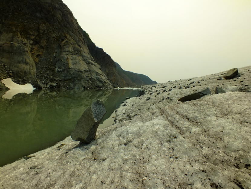
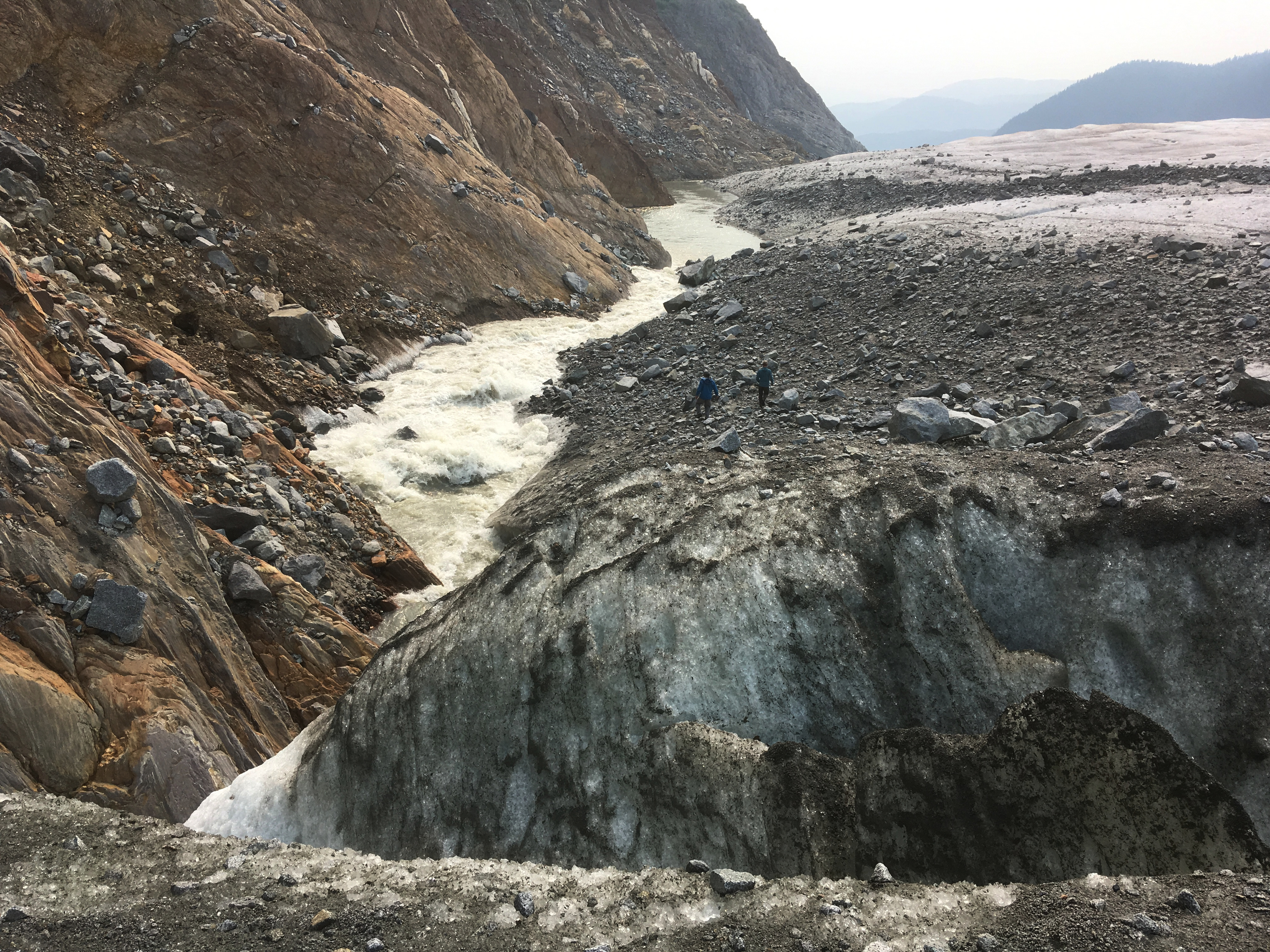
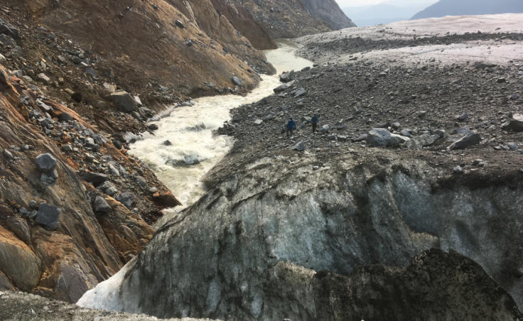
Right now, only a small amount of water is spilling over the ice dam and running down along the edge of the glacier. Granite boulders dot the glacier’s edge, some as big as a car, some balanced precariously on an end. Called glacial erratics, the rocks have been carried down by the glacier for miles.
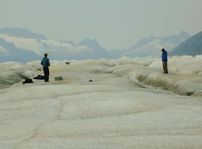
Kienholz takes pictures of the spillover and the glacier’s edge. He sets up an instrument for measuring the spillover water level and ice dam erosion.
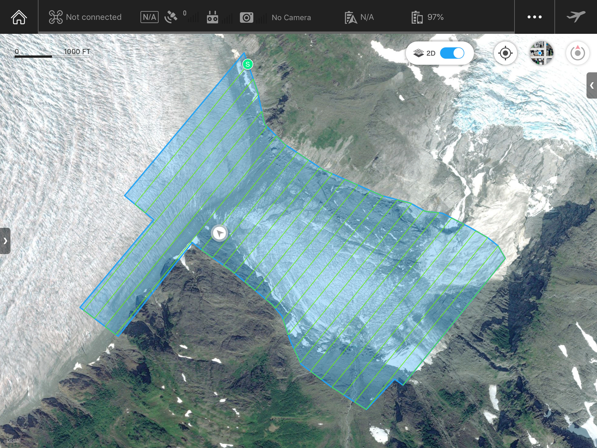
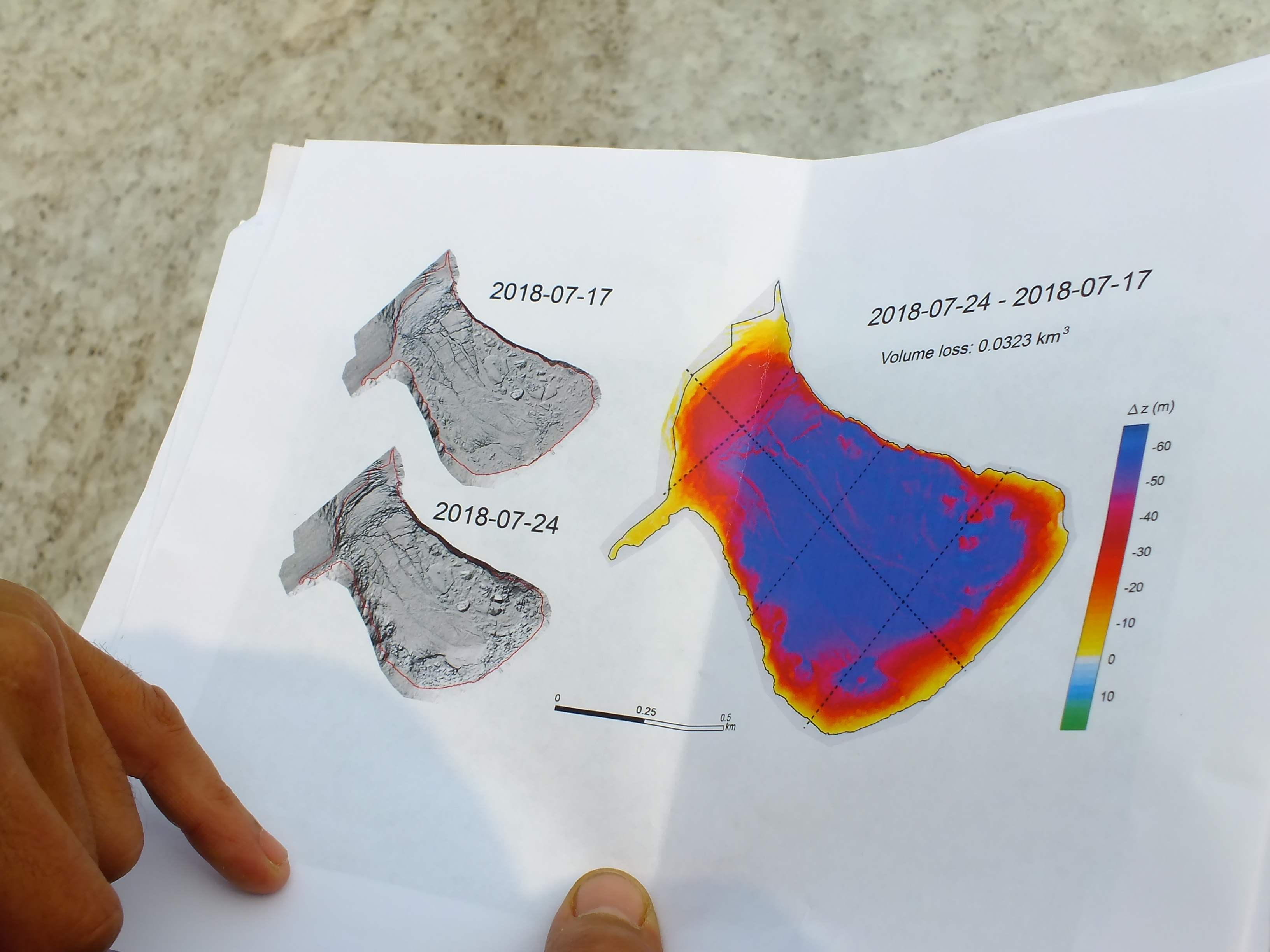
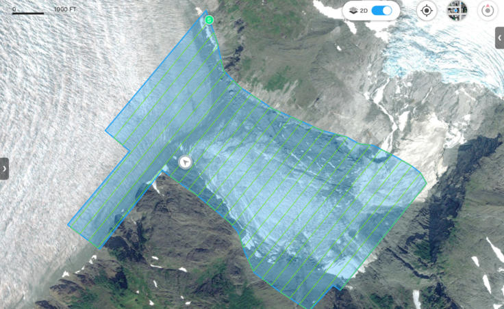
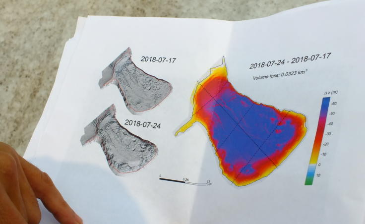
He also uses a drone to take overlapping high-resolution photos of the entire basin. Software will turn those photos into a super-detailed, computer-generated 3D model, which provides important information about how much water could flow into Mendenhall Lake.
“Yeah, you need a powerful computer to process this,” Kienholz said.
This year’s jökulhlaup hasn’t happened as expected. Scientists believe that’s because the glacier is constantly changing and has been thinning so much recently.
Kienholz expected a jökulhlaup shortly after water started spilling over the ice dam on July 7.
A recent calving event near the ice dam may have temporarily blocked the water flow. There’s also less water in the basin this year, and that could mean less water pressure to force open that big pipe.
So, for now, all anyone can do is just watch and wait.
