A warning for high avalanche danger has been posted for the Juneau area.
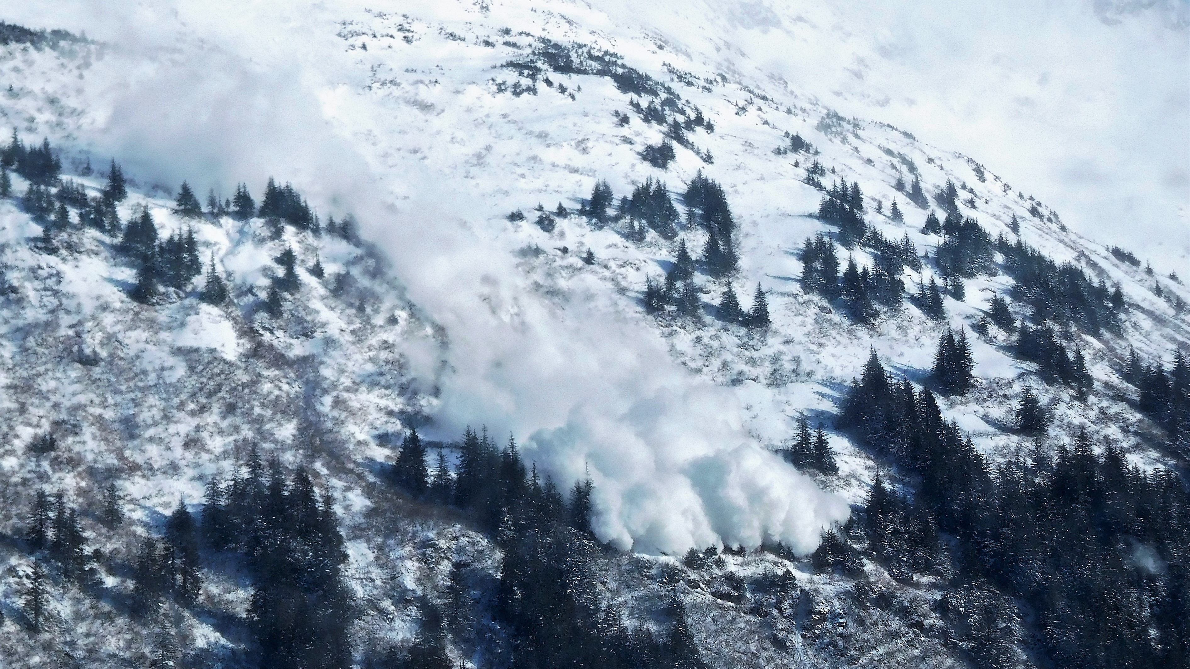
One downtown resident on Friday morning shared a video of a slide coming down the Behrends Avenue avalanche path off of Mount Juneau.
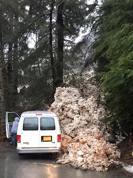
“It came down… I believe it’s Judy Avenue where the gate is there, and it actually came down and took out the gate right at the end of the road there,” said Tom Mattice, the City and Borough of Juneau’s avalanche forecaster.
He said the slide was a combination of dry powder from higher elevations and wet snow from lower elevations on Mount Juneau.
In addition to the gate, Mattice said the slide hit a parked van, but there was no major damage or injuries. The slide stopped about 50 feet short of homes.
Carole Triem caught it on video.
Mattice reports there were also small slides Friday morning on Chop Gully off Mount Juneau and Snowslide Gulch near Thane.
He’s urging everyone to stay away from avalanche terrain this weekend. Some of those areas include the Flume Trail and gated areas above the Behrends neighborhood.
The avalanche danger is also high in the backcountry with potentially catastrophic slides at least 3- to 5-feet deep.
“Every time the snow starts to stabilize day-to-day, then we get a new snowfall and it makes it reactive again,” Mattice said. “Basically, the spring gets stiffer on the trigger and with a new rainfall and the snowfall and the spring gets weaker on the trigger. We’ve been staying very close to a state of natural avalanches on that deeper persistent weak layer.”
“Yesterday, we got over an inch of moisture on Douglas Island. A little less on the (Gastineau) Channel. And the combination with another inch of rain today and the warming due to this moisture today was enough to once again trigger that deeper, persistent weak layer,” he added.
Mattice also said gusts to 50 miles per hour have created considerable windloading on the summits and ridgelines.
