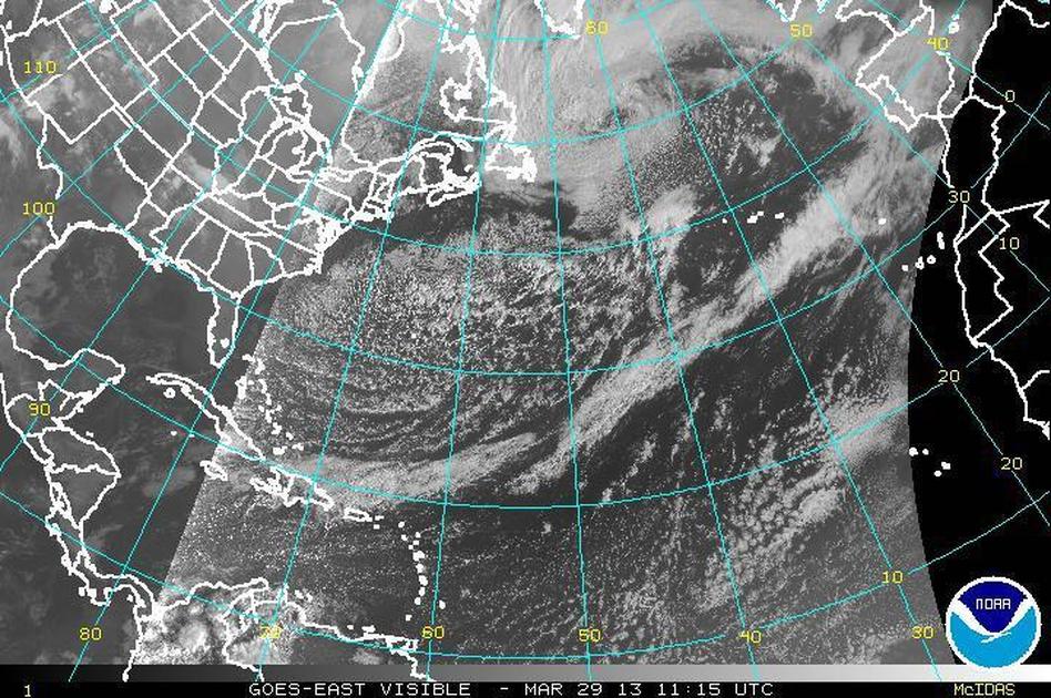
The same weather system that left a few inches of snow on parts of the eastern U.S. earlier this week is now over the North Atlantic, and Jason Samenow of The Washington Post‘s Capital Weather Gang says he’s not sure he’s ever “seen a storm this big before.”
As you can see from this satellite image, it’s a storm that stretches from Newfoundland to Portugal, north to Greenland and has a tail that extends south into the Caribbean.
Wave heights along the storm’s northern edge are projected to approach 30 feet. Capital Weather Gang says it’s an “incredible,” intense storm that’s “comparable to many Category 3 hurricanes.”
Fortunately, this monster is expected to stay out over the ocean for a few days and then weaken as it gets to western Europe next week.
Read original article
Satellite Image Shows ‘Incredible’ Storm Stretching Across North Atlantic
