The National Weather Service has cancelled a flood warning for Mendenhall Lake and Mendenhall River after water levels started dropping on Monday morning.
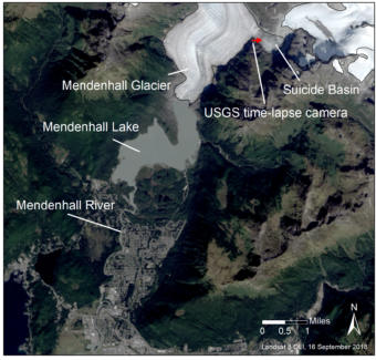
The source of the flood was Saturday’s jökulhlaup or glacial dam release from Suicide Basin adjacent to Mendenhall Glacier.
Jake Byrd of the National Weather Service in Juneau said lake and river water levels crested at 8.62 feet late Sunday, a little earlier than expected and just below minor flood stage.
“While there’s still water coming out of Suicide Basin,” Byrd said, “it’s past that point of peak.”
Because Suicide Basin continues to drain, Byrd warns people to be careful around the lake and river.
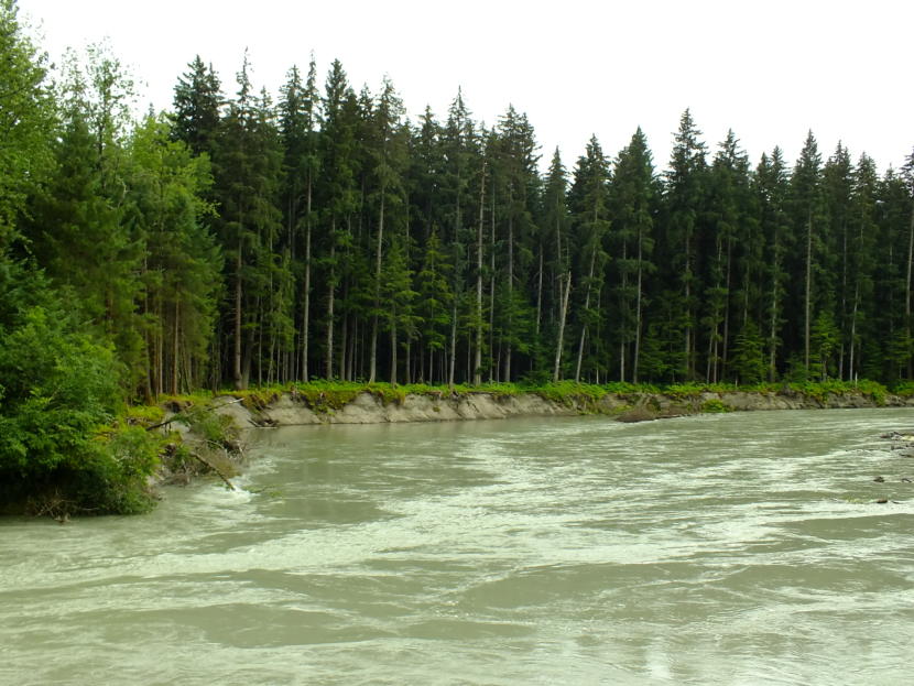
“I wouldn’t recommend going near it or trying to raft down Mendenhall River. Definitely avoid trying to do that,” Byrd said.
Tom Mattice, emergency programs manager for the City and Borough of Juneau, said there was no major damage reported from the flooding. But – as of Monday morning – water levels still had not receded enough to allow a full view of any potential riverbank erosion.
“It turned around pretty quick and didn’t get nearly as high. So, that’s good,” Mattice said.
When asked about why less water was released this time and why the lake and river did not flood as much as expected, Byrd said it’s difficult to make pinpoint predictions with the ever-changing nature of Mendenhall Glacier.
“It’s really hard to get an exact estimate of how much water is actually sitting in Suicide Basin,” Byrd said. “The exact volume of water is uncertain every year just because the glacial dynamics change all the time.”