Almost 50 years ago, The Fairbanks area was deluged by unprecedented rainfall. The precipitation channeled from surrounding hills into the Chena River resulting in an epic flood that devastated the interior city.
Five decades later, signs are going up around Fairbanks to remind people of what happened.
Standing by the Chena River in downtown Fairbanks, National Weather Service hydrologist Ed Plumb explained how an already wet streak in August 1967, culminated with intense precipitation as the remnant of a typhoon pushed across the interior.
“Some places had 6 to 9 inches of rain during that period of time,” Plumb said.
All that rain flowed down the Chena, Salcha and Tanana rivers resulting in the great flood of August 1967. The high water displaced thousands of people, and did tens of millions of dollars in damage, a history Plumb is leading a project to share with the public.
”There’s been more than a generation that’s passed since the flood, and so a lot of people… we’ve run into some people who didn’t even know there was a flood in ’67,” Plumb said. “That piece of history is already being lost.”
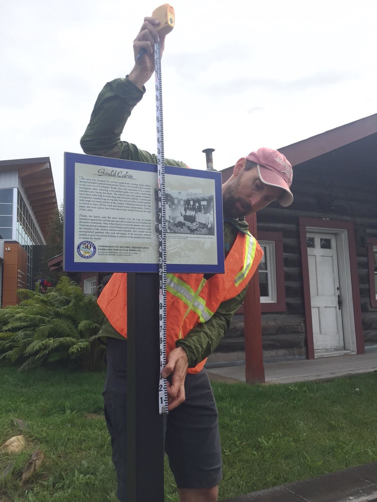
The project includes placement of informational and high water mark signs around town.
Plumb and U.S. Geological Survey hydrologist Matt Schellekens are making measurements for installation of a high water sign near an historic downtown cabin along the Chena.
“Some locations like here, near the river, were looking at about 5 feet of water above ground level,” Schellekens said. “Most places throughout downtown Fairbanks were 1-and-a-half to 3 feet of water.”
Shellekens and Plumb underscore that it wasn’t just the depth of the flood water, but the huge area it encompassed.
”The Tanana was flowing approximately 250,000 cubic feet per second, when 100,000 is considered flooding,” Plumb said.
“It’s hard to estimate because the Chena and the Tanana were one in Fairbanks — one continuous area under water,” Shellekins added.
Shellekens unfolded a flood map in the in the back of his pickup.
“We’ve got Birch Hill here, UAF here and this is Chena Ridge behind the pump house,” Shellekens listed. “The airport which is barely above flood elevation. You can see the blue numbers are the approximate water depth. Over by the library, 2-and-a-half, 3 feet deep.”
Areas of higher ground served as gathering spots for flood evacuees.
Plumb pointed to the bluff near the entrance to the University of Alaska Fairbanks.
”That was sort of a boat landing spot for people evacuating town and getting up onto the higher ground at the University,” Plumb said. “There’ll be a sign there showing how high the water was.”
Plumb noted that water will never reach such heights again due protection provided by the Chena Flood Control dam and levy built after the great flood.
The project in North Pole is the location of one of three interpretive panels marking the 50th anniversary of the ’67 flood.
Alaska Gov. Bill Walker is among officials and local residents scheduled to speak at a flood anniversary event in downtown Fairbanks August 15.
