The Blob is back. The term was coined a few years ago to describe a warm patch of water in the Gulf of Alaska and northern Pacific Ocean. It can turn the weather warm and dry in the state.
Brian Brettschneider is a climatologist in Anchorage who closely tracks Alaska climate data and trends. Alaska’s Energy Desk is checking in with him regularly for the segment- Ask a Climatologist.
Brettschneider says earlier this year, it looked like the Blob was gone, but that wasn’t quite right.
Interview Transcript:
Brian: It’s always been there, it’s just been hovering below the surface, so if you looked at sea surface temperatures, it kind of looked like it was getting back to normal, but all that warmth was just kind of pushed down a little bit and now it’s making its way back to the surface. And it really looks like the blob again.
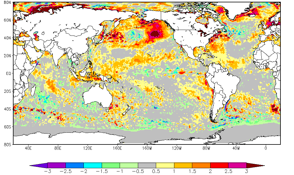
Annie: And when you look at a map of this, it’s really striking, can you describe it?
Brian: When you look at these maps of sea surface temperatures- the ones that have been released the last few weeks- they really show this very pronounced warm water anomaly sitting just south of mainland Alaska in the Gulf of Alaska. Of course the colors they use in the maps in general for above normal conditions are red, so you have this red circle sitting below Alaska and it really does look like a blob.
Annie: What effect does this have on Alaska?
Brian: When there’s warm waters that surround Alaska it really promotes warm surface temperatures in the state. It also affects the upper level patterns. The last time the blob was this pronounced we had a strong upper level high pressure that set up and that really kept us dry. And then to the downstream side of that in Canada and the northern part of the lower 48, that actually drove their winds, made [them] come from the North, so it made it colder and snowier over there. But over here, in our part of the world, it promoted above normal temperatures and below normal precipitation.
Annie: And what is the connection between the blob and global warming?
Brian: Global warming, I like to say, adds a baseline. It’s like a background noise that gets slightly louder every year. But the blob is something that sits on top of that. So for example, at some point in the past, a blob pattern may have only been two or three degrees above normal, whereas now its four or five, maybe six degrees above normal. So it’s just something that adds on to the background conditions.
