At the height of the Cold War, the military built secretive radar sites all over Alaska. Most of them are still operating, doing essentially the same thing: scanning the sky for anything that’s not supposed to be there, particularly Russian long-range bombers.
But technology and policy have reshaped the sites themselves. Recent equipment upgrades have shrunk the size of electronic packages enabling radar operations, and camps that initially housed hundreds of military personnel now house tiny crews of private contractors. In spite of those changes, the structure of Alaska’s vast air defense system remains essentially the same.
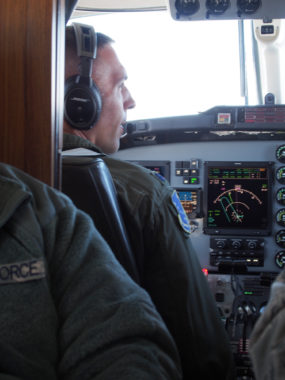
The first barrier getting to one such site was weather. Low gray clouds kept our plane circling in the air, the pilots hoping for an opening after two hours of flying from Anchorage to Cape Romanzof in a small C-12 plane.
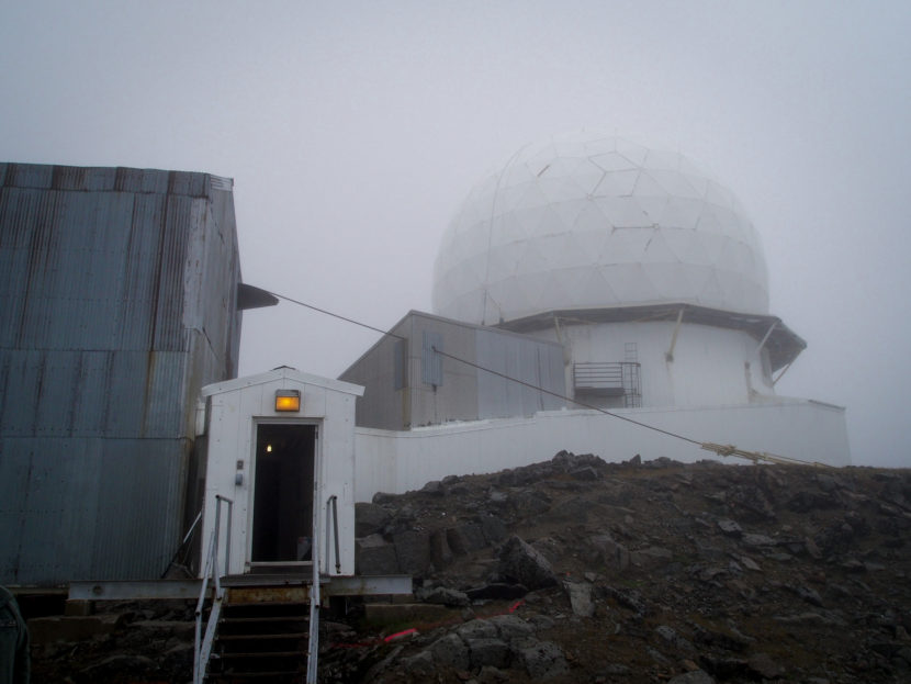
The Long Range Radar site looks out over the mouth of the Yukon River, about 15 miles from Hooper Bay.
The site’s radar technician, Max Jones, waited by the airstrip in a pickup truck.
“This is Cape Romanzof weather,” Jones said. “We have a saying here: come because you have to, stay because the weather won’t let you out.”
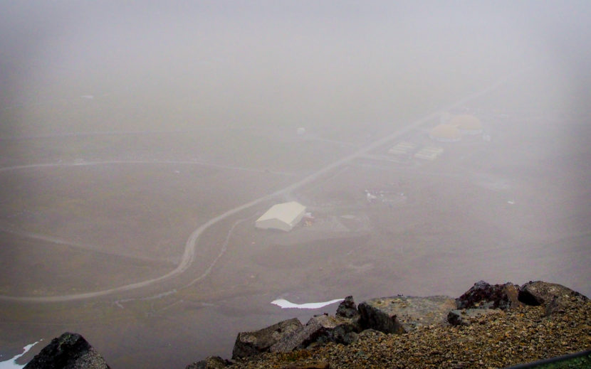
Jones is one of four contractors who work year round at Romanzof. Technicians like him maintain the equipment and facilities at Alaska’s 15 LRR sites, which means doing everything from electrical engineering to plowing the miles of winding road tying the air-strip to the radar building perched a few thousand feet up.
We drove past the two giant domes that house the crew and their heavy equipment before climbing into fog so dense it hid the truck driving behind us.
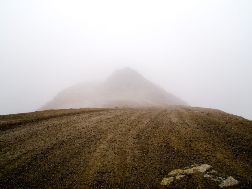
“This is an old volcano,” Jones said of the steep hill, the sides a few feet away totally obscured. “It’s 3,200 feet straight down right there.”
For the last two years Jones has worked for ARCTEC, the private company that’s held the contract to run the sites since 1994. The Air Force began privatizing site operations in the ’70s.
Jones, who spent 20 years in the Navy, said it’s the best job he’s ever had – largely because of the variety of the work. He stays out around three months, then goes home to Tennessee for a month at a time.
“Being out on a remote site doesn’t bother me,” Jones said, slowing the truck to a halt. “But it’s not for everybody.”
We got out and walked into the most important part of the Romanzof site: a cluster of low-slung structures built into the rocky ridge, a defunct tram system dangling off the edge. Propped atop the metallic rectangles is the giant golf-ball shield that houses the Air Force’s Long Range Radar.
“You’re about to enter a restricted area,” Jones said at the end of a worn wooden hallway, a perfunctory tone flattening what sounded like a familiar speech. “There’s no photography inside the restricted area. And the two civilians: I’ve got to have eye contact with you at all times.”
Inside, it looks like a tidy mechanic’s garage, with blocky metal cabinets, industrial fans, and rectangular monitors. My microphone picks up an eerie hum that makes me wonder about radiation. Jones walked us to a backroom with a glowing map of Alaska showing where the other 14 LRR’s are beaming pulses 250 miles in every direction, probing the sky for abnormalities. Jones hovered near a box called the Radar Signal Data Processor that looks like a dehumidifier.
“Without this the radar can’t do nothing,” he explained. “Everything that the radar creates, transmits, receives, is all fed through this.”
If the processor is like the body of a camera, Jones walked us up a metal staircase to show off the optical lens filtering many rays of light. We craned our necks up to peak at the radar itself from underneath.
“See that white wagon wheel up there?” He asked. “You can actually see the bottom of the radar turning.”
He half-joked that we couldn’t look at it up close while it’s spinning because it would melt our insides.
Jones spent his Naval career working on similar radars, and knows his way around the equipment. But he doesn’t decipher the signals. The whole site – all the machinery, the roads, the dome homes – they’re all in place so that this radar can work like a nerve ending, feeding signals back to a distant brain.
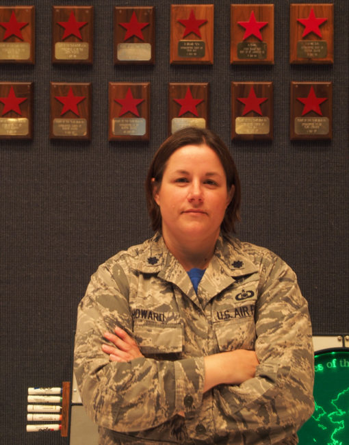
“We detect, identify, track and intercept if necessary, any unidentified traffic within the airspace of Alaska,” said Lt. Col. Carrie Howard of the 176th Air Defense Squadron, part of Alaska’s National Guard.
Howard oversees the large crew at the Regional Air Operations Command, a windowless subterranean facility at Joint-Base Elmendorf-Richardson, 540 miles from Romanzof. It’s filled with glowing computer monitors and looks basically like the war-room in every movie ever made. A piece of equipment gives off a faint green light in the corner, like a Cold War relic. In fact, it was decommissioned in 2006.
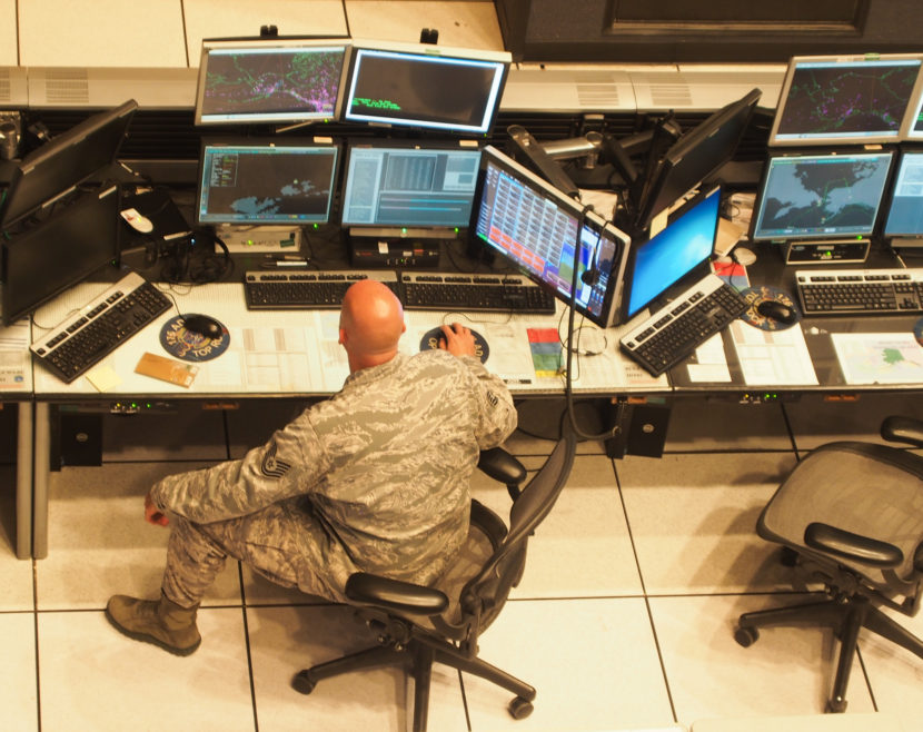
“The radars that are around the state, all of those sensors and all of that data feeds into our facility to display on our battle control system,” Howard said. “It shows up as dots on a screen and location, and from there we can determine if they’re actual aircraft or not.”
Most of the time, the colorful clusters of dots speckled across the maps are noise, flocks of birds or reflections off the ice. But the instruments are sensitive enough to tune out signal interference.
When the RAOC finds something that could be a plane, notifications begin working up the chain of command. The Air Force shares information collected from the radars with civilian partners at the Federal Aviation Administration, who can better assess whether it might be a private or commercial aircraft that is off course. If military commanders decide it’s a foreign craft, they may decide to scramble fighter jets.
According to Howard, personnel here detect Russian military aircraft probing international airspace near Alaska around 10 times a year. Though she declined to speculate on what motivates the incursions, Howard pointed out they tend to happen on U.S. national holidays like the Fourth of July. The background on a nearby computer monitor showed an image of an American F-22 escorting a Russian Bear Bomber last July.
“We’re the front lines, I guess you could say, of air defense,” Howard said.
On the wall were hundreds of red stars for each time such an escort has happened since the radar system was built in the early ’50s.
The information gathered at the RAOC also feeds into the headquarters of the North American Aerospace Defense Command in Colorado, which aggregates similar data from around the continent.
Back at Romanzof, Max Jones explained that the whole expansive apparatus of the LRR defense system — the personnel, equipment, the constant pulse of signals through the air — depends on the radars quietly spinning atop mountains and old volcanoes.
“That’s the mission. Everybody else out here, the plane that you came in on, it’s mission is to support that radar, the thing that goes around above your head.”
