Work began early this year on protecting the highway that serves Alaska’s North Slope oilfields from a repeat of last year’s flooding.
“In December, we started to see overflow on the Dalton Highway near the same area where we had the aufeis and overflow and flooding last year,” says Meadow Bailey, a spokesperson for the Alaska Department of Transportation. Aufeis is a type of ice that forms into piles of sheets, usually caused by overflowing rivers.
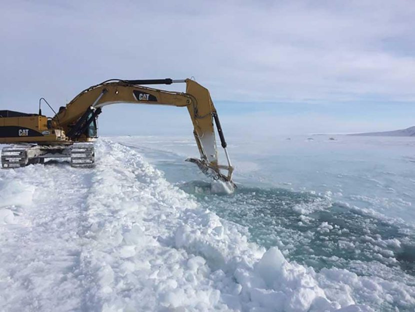
Bailey says workers picked up where they left off last fall on projects to prevent floodwaters from the Sagavanirktok River from washing out the northernmost stretch of the Dalton Highway. Sag River flooding closed the highway several times last year, severing the lifeline to the giant Prudhoe Bay complex.
“We knew that similar conditions were developing,” she said, “and so we took some proactive measures.”
Bailey says workers built the roadbed up to about 10 feet above the surrounding tundra and are digging 5-foot-deep trenches in ice near the highway to divert floodwaters back into the riverbed.
“What we’re trying to do is build an infrastructure that will withstand whatever conditions are present,” she said.
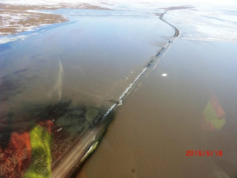
Observers say they’ve never seen the Sag River flood like that. Bailey says there’s only about 50 years of historical climatological data for the area, so it’s hard to determine whether the flooding is unusual and whether it’ll occur again – perhaps, like last year, during spring breakup.
“What we don’t know is what breakup will look like. Based on last year, it was really the most extreme situation that we could have imagined,” Bailey said.
Experts suspect unusually warm winter weather contributed to the flooding. Warmer weather in recent years has presented many new challenges to transportation engineers in the far north, says Billy Conner, who directs the Alaska University Transportation Center at UAF’s Institute of Northern Engineering.
“We’re seeing the possibility of rainstorms in the middle of January – (that) didn’t use to happen,” Conner said. “That throws us in the transportation world into a real tizzy, because we’re not used to dealing with that.”
Conner says climate change probably accounts for some unusual weather. And he says it probably indirectly contributes to roadway damage, for example by creating conditions that increase wildfires, which accelerate permafrost thawing and cause the subgrade of nearby roadways to settle and buckle.
But Conner says oftentimes simply building a roadway creates conditions that cause problems, for example clearing vegetation or altering drainage by building up a roadbed
